
FIRE RESTRICTIONS ARE IN EFFECT through October 31, 2026 at 10 p.m. Wood, charcoal, and propane fires are prohibited.
Due to safety concerns, walk-in entry and hiker drop-off/pick-up is not permitted.
Dump station is not open to the public.
Lost Dutchman Trails
 Hiking Trails
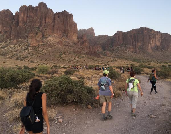
Superstition Mountain Trails traverse through Arizona’s most beautiful Sonoran Desert landscape and the hiking trails at Lost Dutchman State Park are a great place to begin your adventure! Just a stone’s throw from the Phoenix metro area, these trails give hikers a sense of solitude in a relatively remote setting. There are accessible trails like Native Plant, moderate trails like Treasure Loop or Prospector’s View, and even trails for advanced hikers such as Siphon Draw and Flatiron. Regardless of hiking ability, there is a trail for everyone at Lost Dutchman State Park.
Please use caution when hiking at the park. Those planning to use the longer trails should carry a topographic map. Each person should carry at least one gallon of drinking water per day. Remember summer temperatures often exceed 100°F. A trail map is provided with entrance fee. We want your Superstition Mountain hiking experience to be as positive and safe as possible so please use your best judgment before tackling the toughest trails.
Native Plant Trail: The Native Plant trail features beautiful native plants of course! A variety of cholla, prickly pear, ocotillo and more will line your path, with names and pronunciations on labels to guide you along. Make sure to ask for the native plant trail guide at the ranger station for plant descriptions as well! One of the coolest things to see along this trail is the “Watch Me Grow” saguaro – a cactus that the park started measuring 25 years ago! Though slow growing, you can see how the saguaro in time becomes the sentinel of the desert. To find the Native Plant trail, park in the 15 minute parking lot to the right of the ranger station, and follow the path just beyond the accessible parking sign. Tour the trail.
Treasure Loop Trail: Length 2.4 miles round trip, rated moderate, elevation change of 500 feet. It terminates at either picnic area. Tour the trail.
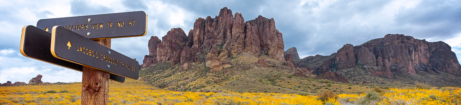
Prospector's View Trail: Length 0.7 miles, rated moderate. It connects Siphon Draw Trail with Treasure Loop Trail also connects with Jacob's Crosscut Trail. Tour the trail.
Jacob's Crosscut Trail: Trail runs 0.8 miles along the base of the mountain, rated easy. It connects Treasure Loop Trail with Prospector's View Trail and continues 4.5 miles past the park area along the base of the Superstitions. Tour the trail.
Siphon Draw Trail: 4 miles round trip, a very scenic hike, this trail winds up into a canyon known as Siphon Draw. It is possible to hike up the Flatiron (5.8 miles roundtrip), although it is not a designated, maintained trail all the way. It's advised that only experienced hikers in good shape attempt to hike to the top, as the climb is steep and difficult to follow. Allow at least five hours for the Flatiron hike, up and back. Tour the trail. Tour Upper Siphon Draw. *This trail is not recommended during hot weather.
Discovery Trail: Connects the campground and day use areas. Features information signs, a wildlife pond, bird feeder and viewing bench. Tour the trail.
Mountain Bike Trail and Vista Loop Trail are also available for virtual tours.
Before you hike, be prepared with enough water and proper footwear as the trails are steep and challenging.
Remember...An Arizona adventure is only a short drive away! Most of your state parks have amazing hiking opportunities for all levels of hikers. Plan a trip today!
Want More AZ Hiking Info?

