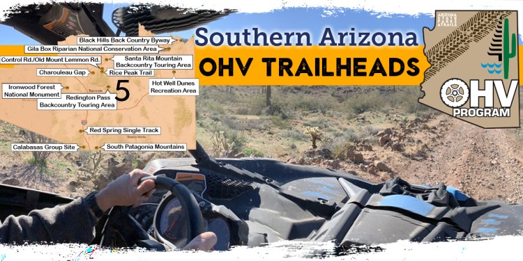
Region Five OHV Trailheads
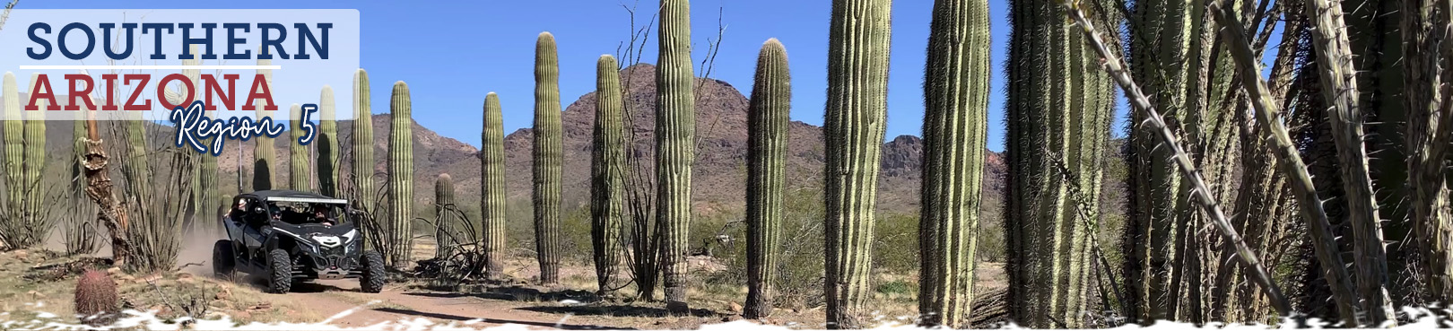
Southern Arizona
Southern Arizona has it all from cholla flats with saguaro accents to the pine covered peaks of sky island country…and everything in between! The rich diversity of this scenic and historic slice of AZ will amaze OHV enthusiasts and keep them coming back for more adventure! Wildlife encounters are common from Southern Arizona OHV trails, and during winter months the local bird populations are supplemented with winter visitors taking advantage of the amazing weather that Region 5 has to offer. Despite its reputation, there are some great summertime OHV adventures in Southern Arizona too. Ride to the top of any accessible sky island and experience a cool break from the summer temps in the surrounding desert. As with any trip, drink plenty of water, even in the high country!
You’ve found Arizona’s most current OHV trail resource! Select an off-road trail from the map and learn more about your impending adventure below. Find out what to expect during your trip, get maps to each of the OHV trailheads, and have important contact info right at your fingertips.
Click the Statewide OHV Trailheads button below to find even more awesome OHV experiences and trailheads throughout Arizona!
Black Hills Back Country Byway
- Land Manager: Bureau of Land Management – Safford Field Office
- The Black Hills Back Country Byway is unpaved, but is accessible to high clearance vehicles during dry weather. Portions of the byway have narrow drop-offs or are confined by steep cliffs. Do not attempt the byway if you have a travel trailer or any vehicle more than 20 feet long. Motor homes and trailers can be left at parking areas provided near kiosks at each end. Please take extra care to drive defensively on this route. Always expect a vehicle around the next bend and remember: mountain courtesy gives uphill traffic the right of way. If you choose to be more adventurous and travel some of the side routes, remember all of these single lane roads require a four-wheel-drive vehicle. These roads are not maintained and portions can be steep, rough, and rocky. Washes crossing these routes tend to make it difficult to tell where the road is at all times.
Box Canyon OHV Trail
- Land Manager: Bureau of Land Management - Tucson Field Office
- Follow a wash into Box Canyon of the Gila River and navigate through tight passages between the rock walls. The trail accesses old mines and an old stage depot. Both Catalina and Oracle state parks are located in the Tucson area. Catalina offers campgrounds, and both have miles of trails for hikers, biking, and equestrian use.
Calabasas Group Site
- Land Manager: Coronado National Forest - Nogales Ranger District
- Calabasas is home to a variety of ecosystems and recreation opportunities. It is located a short distance off Ruby Road near Peña Blanca Lake, 67 miles south of Tucson and 14 miles northwest of Nogales, Arizona. Visit Patagonia Lake State Park for stunning views, campgrounds, cabins, and boating or water activities.
Charouleau Gap Trail
- Land Manager: Coronado National Forest - Santa Catalina Ranger District
- The road up and over Samaniego Ridge is rough and rocky and requires good ground clearance as well as excellent traction. You’ll be impressed by the views, the interesting rock formations in the high country, and the desert oasis at the end of the drive. Before you get to the gap and after you pass over it, the views are broad and expansive. The country you’ll pass through is mostly rolling, grassy hills covered with upper Sonoran, open oak woodland vegetation. After passing through Charouleau Gap, the road drops into the upper reaches of beautiful Cañada Del Oro. This canyon is home to the same ephemeral stream you crossed at the beginning of your climb, several miles and one huge U-turn downstream of where you’ve ended up. In contrast to the broad, sandy riverbed in which you started, these upper stretches of the cañada are filled with big cottonwoods and sycamores and extensive mesquite groves, or bosques.
Control Road/Old Mount Lemmon Road
- Land Manager: Coronado National Forest - Santa Catalina Ranger District
- This rough, winding road that snakes up the northeastern slopes of the Santa Catalinas was the first major access route built to the upper reaches of the Santa Catalina Mountains. The control road still serves as a popular sight-seeing route for those willing to brave a little rough driving. If you approach the old road via the Catalina Highway, it drops off a high ridge just north of the Loma Linda Picnic Area. As it winds its way down the mountain, through an area of old mines and ranches, the road provides broad overlooks of the grassy, oak-covered foothills to the east. In the distance, the San Pedro Valley stretches to the Galiuro Range. Farther in the distance, the upper slopes of the Pinaleno Mountains and their northern neighbors, the Santa Teresas, are visible through low passes in the Galiuros.
- The higher elevation sections of this trail are closed December 15 through March 1.
Gila Box Riparian National Conservation Area
- Land Manager: Bureau of Land Management – Safford Field Office
- The 23,000-acre Gila Box Riparian National Conservation Area includes four perennial waterways, the Gila and San Francisco rivers and Bonita and Eagle creeks. This region is a very special riparian ecosystem abounding with plant and animal diversity. A canyon section, known as the Gila Box, is composed of patchy mesquite woodlands, mature cottonwoods, and sandy beaches. Impressive Gila Conglomerate cliffs tower more than 1,000 feet above the Gila River, and bighorn sheep are commonly spotted. Bonita Creek, a key tributary of the Gila River, is lined with large cottonwoods, sycamores, and willows. Roper Lake and Dankworth Pond state parks are located in Safford, offering camping, cabins, hiking trails, and water activities including fishing.
Hot Well Dunes Recreation Area
- Land Manager: Bureau of Land Management – Safford Field Office
- Sound like a day at the beach? The sands at the Hot Well Dunes Recreation Area were a beach surrounding a lake approximately two million years ago. What remains today is one of the most unique recreation spots in Arizona. Hot Well Dunes provides the opportunity to ride 2,000 acres of sand dunes, set up a camp, and then soak in relaxing hot tubs, all in the same location. However, please be considerate of your neighbors who may not be here to participate in the same activity as you. This is the only way this area will continue to be available to have fun in the sand, sun, and water. Roper Lake and Dankworth Pond state parks are also located in Safford, offering camping, cabins, hiking trails, and water activities including fishing.
Ironwood Forest National Monument
- Land Manager: Bureau of Land Management - Tucson Field Office
- This Ironwood Forest National Monument is made up of 129,000 acres and contains a significant system of cultural and historical sites covering a 5,000-year period. Possessing one of the richest stands of ironwood in the Sonoran Desert, the monument also encompasses several desert mountain ranges including the Silver Bell, Waterman, and Sawtooth, with desert valleys in between. Both Catalina and Oracle state parks are located in the Tucson area. Catalina offers campgrounds, and both have miles of trails for hikers, biking, and equestrian use.
Red Springs Single Track System
- Land Manager: Coronado National Forest - Nogales Ranger District
- The Red Spring Trail is located approximately 4 miles west of Exit 40, Chavez Siding, off of Interstate 19. Access is from Forest Service Road 684. A staging area provides parking for vehicles and trailers. Two Ramadas, picnic tables, and an information kiosk are available. The trail rolls through 25 miles of spectacular rugged scenery. While it was primarily designed for single-track motor bikes, as a multi-use trail it is open to non-motorized recreation, including hiking, bicycling, and equestrian use. A short drive away, visit Patagonia Lake State Park and adjoining Sonoita Creek State Natural Area for stunning views along hiking trails, campgrounds, cabins, and boating or water activities.
- Trail Maps
Redington Pass Backcountry Touring Area
- Land Manager: Coronado National Forest – Santa Catalina Ranger District
- Located approximately 12 miles northeast of the city of Tucson and 24 miles south of San Manuel, Redington Road is the only access into this OHV recreation and natural resource area. Motorized travel is permitted only on designated routes. The secondary dirt roads found in this touring area are very rugged, and will challenge your technical driving skills. A high ground clearance 4X4 vehicle is strongly recommended. ATV and dirt bike riders find this area just as technically challenging. This is a high desert and oak woodland area with notable features including Chimney Rock and Chiva Falls.
Rice Peak Trail
- Land Manager: Coronado National Forest - Santa Catalina Ranger District
- Rice Peak is an aggressive climb up to a sub-summit of Mount Lemmon with long views to the west, north, and east that starts near Peppersauce Cave and campground.
Rug Road
- Land Manager: Bureau of Land Management - Safford Field Office
- Rug Road got its name from the remnants of carpet that people have used to fill holes and ledges along the road to make it more passable. The road is one of the roughest roads in the Safford Field Office. The road transverses Table Mountain between Turkey Creek on the east end and Mammoth on the west end. It is only about 20 miles long but will take a full day to traverse. This is a serious four-wheel-drive road. Roper Lake and Dankworth Pond state parks are also located in Safford, offering camping, cabins, hiking trails, and water activities including fishing.
Santa Rita Mountain Backcountry Touring Area
- Land Manager: Coronado National Forest – Nogales Ranger District
- Just west of Highway 83 and north of Sonoita, the east side of the Santa Rita Mountains offers miles of roads in high desert and oak woodland foothills. This area is subject to all seasons, and you must avoid wet conditions. Visit Patagonia Lake State Park and adjoining Sonoita Creek State Natural Area for stunning views along hiking trails, campgrounds, cabins, and boating or water activities.
San Simon Valley
- Land Manager: Bureau of Land Management - Safford Field Office
- Approximately 500,000 acres of public land in the San Simon Valley provide diverse recreational opportunities. This Special Recreation Management Area provides unique opportunities for off-highway vehicle riding and hot-water soaking. Wildlife species in the area include quail, dove, deer, and javelina. Roper Lake and Dankworth Pond state parks are located nearby in Safford, offering camping, cabins, hiking trails, and water activities including fishing.
South Patagonia Mountains
- Land Manager: Coronado National Forest – Sierra Vista Ranger District
- Between Nogales and Sierra Vista and east of Highway 82, the Patagonia Mountain range offers many opportunities for OHV recreation. This area includes high desert scrub and oak woodland. This area is usually accessable during all seasons, however trail users should avoid wet conditions.
- Take Duquense Road past Kino Springs to the Sycamore Canyon Area and beyond.

