Region Two OHV Trailheads
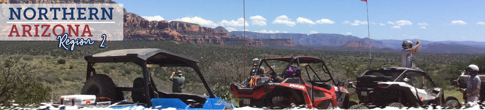
Northern Arizona
Region 2 spans from Sedona to the Strip and gives off-highway enthusiasts a chance to experience a wide variety of Northern Arizona OHV trails within its boundaries. Want to access one of the more remote places to ride in the Western US or tackle famously scenic routes through Red Rock County? How about a picturesque OHV experience amid the pines near Flagstaff? It’s all available below!
We’ve designed this resource to help you plan your next OHV adventure more efficiently so you can focus more intently on the unforgettable memories you’ll make from the trail. Find land manager and trail information below plus directions to OHV trailheads throughout the region
.jpg)
Click the Statewide OHV Trailheads button below to find even more awesome OHV experiences and trailheads throughout Arizona!
Arizona Strip East
- Land Manager: Bureau of Land Management - Arizona Strip Field Office
- Start from Buffalo Ranch Road off of US 89A on a remote route with views of the Vermillion Cliffs and access to Kaibab National Forest. The route also intersects the Great Western Trail.
Arizona Strip West
- Land Manager: Bureau of Land Management – Arizona Strip Field Office
- The Arizona Strip, “where the west stays wild,” is that vast region of Arizona north of the Colorado River. Much of this remote and largely unsettled area is traversed by more than 5,000 miles of dirt roads. Road conditions range from well-maintained graded roads to high-clearance two-tracks to challenging routes which require 4-wheel drive vehicles. No services are available in this largely backcountry area, so be prepared. Motorized vehicles are generally limited to existing routes, with wilderness areas closed and National Monuments limited to designated routes. Watch for signs in these areas, with terrain that ranges from High Desert to Ponderosa Pine Forest. While this area is generally suitable for all seasons, you should avoid use in wet weather. Contact the Bureau of Land Management, Arizona Strip Field Office at (435) 688-3200.
Broken Arrow
- Land Manager: Coconino National Forest - Red Rock Ranger District
- 4 miles round trip. Forest Road: 179F & 179E. Very challenging, skilled drivers recommended. Features slick rock, rock ledges and “the steps.” Expect heavy traffic, as this trail is popular with jeep tours, hikers, and bikers. Modified high clearance vehicles with short wheel base and skid plates recommended, not for stock vehicles. Please respect the neighbors and observe speed limits and minimize noise.
- No trailer parking available.
- No camping allowed.
Casner Mountain Trail #8
- Land Manager: Coconino National Forest - Red Rock Ranger District
- Casner Mountain Trail is designated as a motorized trail with very rugged conditions along a narrow ridge with limited opportunity for two-way traffic. Gates are closed year-round, but access can be gained by the following: For ATVs/dirt bikes, the trail is open between the FR 525C/9529 intersection at the bottom of the mountain and FR 538B, where the trail enters the Flagstaff Ranger District at the top. For OHVs/modified 4WD, a permit is required. The road is only open for permitted access between mid-May and mid-October. Any questions on Casner Mountain road or the permit system can be directed to 928-203-2912.
- No camping allowed.
Cinder Hills OHV Area
- Land Manager: Coconino National Forest - Flagstaff Ranger District
- This area comprises an extensive stretch of deep volcanic cinders in a ponderosa pine forest, east of Highway 89 and south of Sunset Crater National Monument. You are asked to protect the privilege of riding in this designated off-highway vehicle area by respecting the boundary of Sunset Crater National Monument. Approximately 13,500 acres are available for all types of motorized vehicles. This area encompasses Ponderosa pine forest and is open all seasons, with occasional snow in winter. To get to the Cinder Hills OHV Area, drive northeast of Flagstaff on U.S. 89 approximately seven miles north of Flagstaff Mall. Turn east (right) on FR 776. Contact Coconino National Forest, Flagstaff Ranger District at (928) 526-0866.
- Land Manager: Coconino National Forest - Red Rock Ranger District
- 5.5 miles one way. Forest Road: 9845 - 9845A - 9845H - 9845N
- The trail offers nice views of Dry Creek, but has rocky ledges and steep downhill obstacles. Suitable for most high-clearance 4x4s.
- No camping allowed.
Diamondback Gulch
- Land Manager: Coconino National Forest - Red Rock Ranger District
- This is a 6 mile loop. Forest Road: 152A - 9513. The north section (152A) can be very slick and may be impassible when it rains. Includes a steep, rocky pipe line on the west end (9513). This is a popular route suitable for most high-clearance 4x4s.
- No camping allowed.
Fort Valley Trail System
- Land Manager: Coconino National Forest – Flagstaff Ranger District
- Located at the base of the San Francisco Peaks, the Fort Valley Trail System was designed primarily for connecting popular mountain biking trails. This system is a multi-use trail to be used by bicycles, hikers, horses and motorcycles. Several sections of the trail were designed by a local biking organization to provide a more challenging ride for the more experienced mountain bike rider. The trail consists of loops that link with Schultz Creek, Dry Lake Hill and Mt. Elden trail system.
Kelly/Munds Park Motorized Trail System
- Land Manager: Coconino National Forest - Flagstaff Ranger District
- The Kelly Motorized Trail System is south of Flagstaff, Arizona, south of Lake Mary Road (opposite the Skunk Canyon, Fay Canyon, Sandy's Canyon area). Vehicles must stay on designated roads and trails.
Mount Elden Lookout Road
- Land Manager: Coconino National Forest – Flagstaff Ranger District
- The Mt Elden Lookout Road experience is about 10 miles roundtrip. Rise to more than 9,100 feet in altitude to overlook all of Flagstaff. To get there, travel north on Highway 180 out of Flagstaff until you reach Schultz Pass Road. Go east on Schultz Pass Road and keep to the right until you hit dirt, which is the beginning of Forest Road 557 (a.k.a. Mt Elden Lookout Road). This road is usually closed during the winter season due to snow. The road itself is graded and not too rough, but it has some nice switchbacks and hairpin turns, so be careful because you will be sharing the road with other vehicles and mountain bikers at times. Nearby Schultz Pass offers another option for an easy gravel route.
North Timp Snowmobile Route
- Land Manager: Kaibab National Forest - North Kaibab Ranger District
- The route to Timp and North Timp Viewpoints is a beautiful drive through a ponderosa pine forest. Both points offer a panoramic view of the Grand Canyon and its tributary canyons. Timp Point is the only known, easily accessible point on the Kaibab Plateau where it is possible,with binoculars, to see Thunder River as it emerges from the north wall of Tapeats Canyon.
Outlaw OHV Route
- Land Manager: Coconino National Forest - Red Rock Ranger District
- 6 mile loop. Forest Road: 9549 - 9549B - 9551. Most of loop is easy, with several steep, rocky sections, and bedrock shelves to climb. Scenic views from top of mesa of red rocks and Black Mountain. See ancient ruins and pictographs at Honanki Heritage Site or Palatki (requires reservation and Red Rock Pass). Suitable for most high-clearance 4x4s.
- No camping allowed.
Powerline OHV Trail
- Land Manager: Coconino National Forest - Red Rock Ranger District
- 6.5 miles one way. Forest Road: 9524. Steep and rocky,ups and downs, marvelous red rock views and very remote. There are a few difficult rock shelves where high clearance 4x4’s need to pay close attention. Please make sure to close the gates after you go through. Suitable for most high clearance 4x4s.
- No camping allowed.
Ranch Loop
- Land Manager: Coconino National Forest - Red Rock Ranger District
- Ranch Loop - 6.5 Mile Loop. Forest Road: 525 - 761B - 761 - 525A. This is an easy, sandy trail with several dry wash crossings. The loop route offers a quiet, serene route. Suitable for most 4x4s or AWD vehicles. High-clearance recommended.
- No camping allowed.
Schnebly Hill
- Land Manager: Coconino National Forest - Red Rock Ranger District
- Forest Road 153 is 11 miles one-way, and one of the most scenic routes in this region. It is a rough, rocky road with a more difficult section near the “merry-go-round ” with slick rock ruts requiring strategic tire placement. Popular with jeep tours. Suitable for most high-clearance 4x4s. Please respect the neighbors and observe speed limits and minimize noise.
- Sedona, AZ attractions: Red Rock and Slide Rock state parks.
- No trailer parking available.
- No camping allowed.
Smasher Canyon
- Land Manager: Coconino National Forest - Red Rock Ranger District
- 3.5 miles one-way. Motorized Trail #88. This is an extremely difficult one-way canyon that requires expert skills. It includes steep rock shelves and large boulder obstacles. Be prepared for serious obstacles and rock crawling. Highly modified 4x4 rock crawlers required (NO stock vehicles).
- No camping allowed.
Soldier Pass
- Land Manager: Coconino National Forest - Red Rock Ranger District
- 2.5 miles round trip. Forest Road: 9904 - 9904B. PERMIT REQUIRED at least 72 hours in advance available on the Coconino National Forest website. Road open daily 8 a.m.-6 p.m. only. This is a scenic route with challenging rock ledges and obstacles. Access is through neighborhood streets, so please respect the neighbors. Observe speed limits and minimize noise. Suitable for most high-clearance 4x4s.
- No trailer parking avilable.
- No camping allowed.
Toroweap Overlook
- Land Manager: National Park Service - Grand Canyon National Park
- Sunshine Route to Tuweep/Toroweap Valley and Overlook: County Road #109, the most reliable route, leaves AZ 389 eight miles (13 km) west of Fredonia or six miles (10 km) east of Pipe Spring National Monument. This 61-mile (98 km) road features sharp rocks, washboarding, and dust. Please do not stop on tribal land when traveling this route. High clearance vehicles required.
Vultee Arch
Land Manager: Coconino National Forest - Red Rock Ranger District
- 4 miles one-way. Forest Road 152. Moderately demanding, with several rock shelves and ledges. Several trailheads for scenic hikes such as Devil’s Bridge, Van Deren Cabin (FR9917), or Vultee Arch. Expect to see many hikers on the road. Suitable for most high-clearance 4x4s. Respect the neighbors. Observe speed limits and minimize noise.
- No trailer parking available
- No camping allowed

