Region Three OHV Trailheads
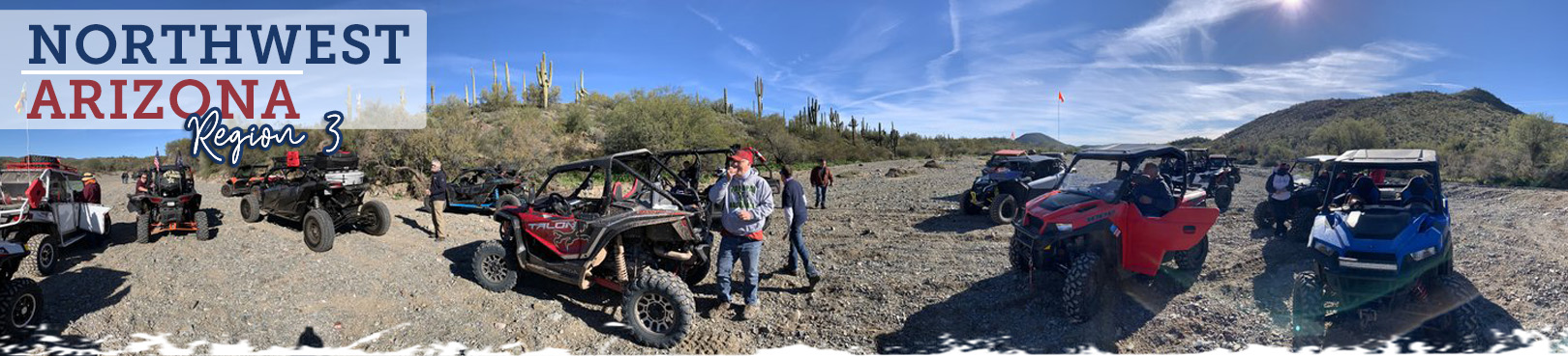
Northwest Arizona
Riders have distinct options within Region 3 and can choose their adventure according to their preference of scenery and location. There are a variety of lesser-known trails within this region that are are perfect for OHV enthusiasts who prefer fewer distractions while exploring Arizona’s most picturesque and memorable OHV trails. Do you prefer the cool breeze of a pine country adventure? You’ll feel right at home amid the pine-studded trails of a Mingus or Granite mountain off-road experience. Are you more into rugged desert trails rich with Arizona mining history? A trip to an Oatman area trail might be just right for you. Hopefully you try both types of OHV experiences and find a hidden-gem-of-a-trail among Region 3’s historic mining country.
You’ve found Arizona’s most current OHV trail resource! Select a trailhead location from the map and learn more about each unique off-road adventure below. Find out what to expect during your trip, access maps to each of the OHV trailheads, and have important land manager contact info right at your fingertips. We’re helping you plan so you can focus more intently on the adventure!
.jpg)
Click the Statewide OHV Trailheads button below to find even more awesome OHV experiences and trailheads throughout Arizona!
Alto Pit OHV Area
- Land Manager: Prescott National Forest – Bradshaw Ranger District
- ATV and dirt bike riders (off-road vehicles of 50” or less in width) enjoy 400 acres with approximately 20 miles of motorized trails, two cross-country areas, and a designated children's area. The main area is a former gravel pit at 6,200 foot elevation just below Granite Mountain. There is also a smaller gravel pit. The surface is rock and granite. A host is available to provide information and assist visitors.
Box T Staging Area
- Land Manager: Prescott National Forest - Verde Ranger District
- Recreation areas with OHV trail riding at Blue Monster Wash Trail #526, Camp Verde Trail #545, Copper Canyon Trailhead, Grapevine Trail #543, Ryal Canyon Trail #521, and Sand Wash Trail #527. Check out nearby state parks: Rockin' River Ranch State Park and Fort Verde State Historic Park in Camp Verde, Dead Horse RanchState Park in Cottonwood, and Red Rock and Slide Rock state parks in Sedona.
Camp Wood Area
- Land Manager: Prescott National Forest - Chino Valley Ranger District
- High in the cool pines northwest of Chino Valley, the Camp Wood area has no developed recreational facilities, but has a variety of trail-use and dispersed camping opportunities. If coming from the east/Prescott, access the area from the junction of Williamson valley Road and County Road 68/FR 21.
Cherry Area
- Land Manager: Prescott National Forest - Verde Range District
- Recreational opportunities in the Cherry area include camping, hiking, mountain biking, horse riding, scenic driving, and OHV riding. Trails in the area include Medlar Springs #9706 and Grapevine Gulch Trail #9708.
Chloride Mines/Windy Point
- Land Manager: Bureau of Land Management - Kingman Field Office
- Windy Point Recreation Site is located along the crest of the Cerbat Mountains, high above the old mining town of Chloride, Arizona. Located at a 6,000 foot elevation, this site is located in a picturesque woodland consisting of pinyon pine and juniper. Visitors here are treated to spectacular views of the surrounding valley and distant mountain ranges. The Windy Point Campground can serve as a staging area for OHVs and has a restroom.
Copper Basin Dunes OHV Area
- Land Manager: Bureau of Land Management - Kingman Field Office
- This designated area is perfect for those who enjoy riding off-highway vehicles. It features a spacious parking area, a convenient unloading ramp, and well-maintained toilets for visitors' comfort. It's important to note that all OHVs must either be street-legal or have state-required off-road vehicle stickers to ensure compliance with regulations. The site is located near resort facilities, providing easy access to amenities and recreational activities. Whether you're a seasoned rider or just starting out, this OHV playground is a great place to explore the outdoors and have some fun.
Copper Canyon Trailhead
- Land Manager: Prescott National Forest - Verde Ranger District
- The Copper Canyon Trailhead Project is a multi-use trailhead located just outside of Camp Verde on the Prescott National Forest. The trailhead is located on Forest Road 136 and provides a connection to the Hayfield Draw OHV Area located about 10 miles away (on Highway 260) via Trail 545. FR136 provides a connection to the Great Western Trail and a scenic ride to the top of Cherry Peak. Check out nearby state parks:Rockin' River Ranch State Park and Fort Verde State Historic Park in Camp Verde, Dead Horse Ranch State Park in Cottonwood, and Red Rock and Slide Rock state parks in Sedona.
Dugas/Tule Mesa
- Land Manager: Prescott National Forest - Verde Ranger District
- Large area geographic area; encompasses riparian habitat to ponderosa pine. Recreational opportunities include: hiking, mountain biking, horse riding, OHV trail and road riding, dispersed camping, and Sycamore Cabin, a historic rental cabin. Trails in the area include Pasture Tank Trail #516, Sycamore Trail #503, and Yellow Jacket Trail #524.
Groom Creek
- Land Manager: Prescott National Forest - Bradshaw Ranger District
- Located in the cool pines of central Arizona, Groom Creek offers a variety of recreational opportunities including: camping, picnicking, hiking, mountain biking, bouldering, and horseback riding. Groom Creek area day use sites and trails are open year-round; campgrounds are open from May 1 to October 31 and closed during the winter.
Hayfield Draw/Bryant Park
- Land Manager: Prescott National Forest – Verde Ranger District
- Approximately 80 acres of motorized trails and cross-country areas for motorcycles and OHVs of less than 50-inches in width. Trails and open pit areas challenge rider skill levels from beginner tot to experienced adult. Please ride in the area most appropriate to your skill level to reduce the risk of accidents. The area where cross-country use is restricted is delineated by orange fiberglass posts. Each skill level area is marked with different colored fiberglass posts.
Hualapai Mountain Park
- Land Manager: Mohave County Parks - Hualapai Mountain Park
- This area near Kingman offers access to hundreds of miles of old mining routes. Motorized travel is limited to existing routes. Elevations range from 6,500 feet in the pines to 1,000 feet in the low desert. The facility is a fee area which offers cabins, camping and a staging area. Contact Hualapai Mountain Park at (928) 757-3859.
Iron Springs/Jerome Canyon
Land Manager: Prescott National Forest - Bradshaw Ranger District
Recreation opportunities include hiking, horse riding, OHV riding, and mountain biking. Trails in the area include: Box Culvert Trail #620, Granite Tank Trail #9406, Sierra Prieta Trail #366, and Toohey Trick Tank Trail #9440.
Juniper Mountain
Land Manager: Prescott National Forest - Chino Valley Ranger District
Recreational opportunities include hiking, mountain biking, dispersed camping, horse riding, and OHV trail riding. Please note: mechanized travel is prohibited within the boundaries of the Juniper Mesa Wilderness. Areas open for off-highway vehicle use include Old Military Trail #1 and Spur Gulch Trail #9942.
Mingus Mountain
Land Manager: Prescott National Forest - Verde Ranger District
Starting just outside of Cottonwood on Mingus Avenue which becomes Forest Road 493, riders can ascend Mingus Mountain on a narrow gravel road ascending over 3000’ as a bypass to 89A through Jerome. Near the summit of Mingus Mountain, other recreational activities are available from picnicking by Mingus Lake to hiking to hang-gliding. Check out nearby Dead Horse Ranch State Park or visit Jerome State Historic Park.
Mohave Milltown East Trailhead
Land Manager: Bureau of Land Management - Kingman Field Office
The Mohave and Milltown Railroad Motorized Trail intertwines with a historic railroad grade. This 7-mile trail is designated for OHV and equestrian use and runs parallel to the non-motorized trail. The route is marked with signs and rock cairns. The best season is anytime from September through May. In the event of plentiful winter rain, wildflowers can be abundant February through April.
Mohave Milltown West Trailhead
Land Manager: Bureau of Land Management - Kingman Field Office
The Mohave and Milltown Railroad West Trailhead accesses the motorized and non-motorized trails. OHV and equestrian users follow a route that does not lie on the grade, but parallels and frequently crosses the railroad bed. The route is marked with signs and rock cairns. The best season is anytime from September through May. In the event of plentiful winter rain, wildflowers can be abundant February through April.
Moss Wash OHV Trail
Land Manager: Bureau of Land Management – Kingman Field Office
Moss Wash OHV Trail is a moderately challenging 10-mile trail that meanders through scenic high mountain forest and Mohave Desert vegetation. In the higher elevations is a forest of ponderosa pine, gambel oak, New Mexico locust, and various grasses and forbs. In the lower elevations is a chaparral plant community consisting of Sonoran scrub oak, manzanita, desert ceanothus, silktassel, and scattered pinon pine. The trail travels along Moss Wash underneath the tall pines or within a riparian area of Arizona black walnut and species of willows. The trail passes several areas of historic mining activities, including Gold King Mansion. The Wild Cow Springs Campground is at the upper end of the trail.
Perkinsville/Hickey Mountain
Land Manager: Prescott National Forest - Chino Valley Ranger District
Area northeast of Chino Valley, and southwest of Sycamore Canyon. Recreation areas with activity OHV Trail Riding include Black Mesa Trail #9036, Coyote Trail #101, Martin Canyon Trail #103, Secret Trail #58, and Sycamore Trail #9033.
Prescott Valley South
Land Manager: Prescott National Forest - Bradshaw Ranger District
Hiking, mountain biking, horse riding, and motorized trails. There are no developed recreation sites in this part of the forest. OHV trail riding opportunities include Red Mountain Trail #43 and White Horse Tank Trail #354.
Ryal Canyon Trailhead
- Land Manager: Prescott National Forest - Verde Ranger District
- Recreation areas with OHV trail riding at Blue Monster Wash Trail #526, Camp Verde Trail #545, Copper Canyon Trailhead, Grapevine Trail #543, Ryal Canyon Trail #521, and Sand Wash Trail #527. Check out nearby state parks: Rockin' River Ranch State ParkandFort Verde State Historic Park in Camp Verde, Dead Horse RanchState Park in Cottonwood,and Red Rock and Slide Rock state parks in Sedona.
Land Manager: Prescott National Forest - Chino Valley Ranger District
There are no developed recreation sites in this part of the forest. Recreation areas with activity OHV trail riding include Brushy Tank Trail #9913, Cabin Springs Trail #9874, Cement Troughs Trail #918, Coop Tank Trail #667, Section 23 Tank Trail #9878, and the Short Cut Trail #9915.
Sheridan Mountain/Smith Mesa
Land Manager: Prescott National Forest – Chino Valley Ranger District
Sheridan Mountain Trail #11 runs north-south along the western flank of Sheridan Mountain, south of the Camp Wood area. The trail passes through pinyon-juniper woodland and chaparral, where scrub jays, rabbits, coyotes, and other animals make their homes. Fortunate visitors may spot wildlife along the trail. This trail passes through some of the most rugged and remote pieces of country in northern Arizona, offering outstanding opportunities for solitude and backcountry orienteering.
Sleeping Princess OHV Trail
Land Manager: Bureau of Land Management – Kingman Field Office
This challenging OHV trail climbs up to the top of the Black Mountains for 3.2 miles and gains approximately 1,600 feet in elevation. A variety of conditions contribute to its treacherous attributes including steepness, off-camber, narrow passages, loose surfaces, sharp turns and ledges/drop-offs. At the top of the trail, visitors can enjoy spectacular views of Lake Mohave and the surrounding mountains. It's a great trail ride for the hardcore Jeeper!
Standard Wash OHV Area
Land Manager: Bureau of Land Management – Lake Havasu Field Office
This area is an unrestricted playground for OHVs, ATVs, UTVs, Jeeps and other off-highway vehicles. The site is one of the major access points to the Lake Havasu Travel Management Trail System. Vehicles must be street legal or have state required off-highway vehicle stickers. Check out great state parks near and in Lake Havasu: Cattail Cove and Lake Havasu state parks, and Buckskin Mountain and River Island state parks in Parker. All have campgrounds and boat/water access, and Lake Havasu State Park offers beachside cabins.
Wild Cow Springs Campground
- Land Manager: Bureau of Land Management - Kingman Field Office
- Windy Point Recreation Site is located along the crest of the Cerbat Mountains, high above the old mining town of Chloride, Arizona. Located at a 6,000 foot elevation, this site is located in a picturesque woodland consisting of pinyon pine and juniper. Visitors here are treated to spectacular views of the surrounding valley and distant mountain ranges. The Windy Point Campground can serve as a staging area for OHVs and has a restroom.
Wilhoit
Land Manager: Prescott National Forest - Bradshaw Ranger District
Trails are open for hiking, horse riding, OHV riding, and mountain biking. There are no developed recreation sites in this part of the forest. OHV riding trails include: Buzzard Trail #129, Cherry Creek Trail #214, Climax Trail #274, East Copper Trail #260, Glen Oaks Trail #118, Orofino Trail #107, and Wolverton Mountain Trail #9415.
Windy Point Recreation Area
Land Manager: Bureau of Land Management – Kingman Field Office
Windy Point Recreation Site is a beautifully rugged destination in the Cerbat Mountains of Arizona. The site sits at an elevation of 6,000 feet and offers breathtaking views of the surrounding valley and mountain ranges. The woodland here is made up of pinyon pine and juniper trees, creating a picturesque setting. Visitors can enjoy a variety of activities at Windy Point, including camping, picnicking, birding, off-highway vehicle driving, and hunting. The nearby Cherum Peak Trail is perfect for hiking. Whether you're looking for a peaceful escape in nature or an adventure-filled getaway, Windy Point Recreation Site has something for everyone.

