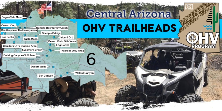
Region Six OHV Trailheads
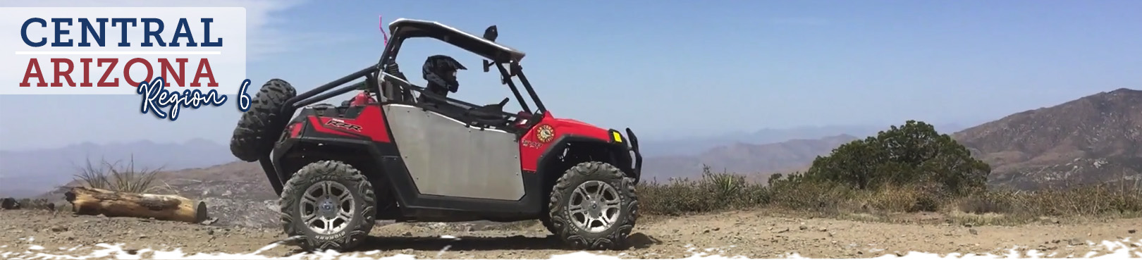
Central Arizona
From Prescott to Casa Grande, and Wickenburg to just west of Safford, Region 6 offers a variety of unique central Arizona riding opportunities. These OHV experiences can vary from scenic Sonoran Desert rides that wind through narrow, rugged canyons, to beautiful overlooks and lake views, all the way up into juniper country, and beyond into pine tree studded trail network of the Payson area.
Region 6 has it all…Take a look at the staging areas below and use these spots as a starting point for your Arizona adventures. We strongly recommend that you “know before you go” by researching the area and contacting the appropriate land manager directly with any questions about closures, weather, fire restrictions, and trail conditions. We’ve provided contact and other relevant information in each of the staging area sections for your convenience
We hope you enjoy these great riding opportunities and remember to ride safe, ride smart, ride sober! Always pack out what you take in so that these areas can remain open for future generations of Arizona’s OHV community.
Click the Statewide OHV Trailheads button below to find even more awesome OHV experiences and trailheads throughout Arizona!
Staging Areas
Locate trails on the map, then find more info below including land manager and area information, plus Google Maps directions to each staging area.
Boulders OHV Staging Area
-
- Land Manager: Bureau of Land Management – Hassayampa Field Office
- This is a popular staging area for the Lake Pleasant/Hieroglyphic Mountain OHV recreation area, which showcases a motorized off-highway route system in the scenic upper Sonoran Desert landscape. With over 200 miles of unimproved backcountry roads and single-track motorbike trails, ranging from 1,700 to 3,500 feet in elevation, this recreation area is bound to please any off-highway vehicle (OHV) enthusiast. The semi-primitive staging area has over 10 acres available for camping and includes a vault restroom and information kiosk. There are no designated campsites, drinking water, dumping stations, picnic tables or shade structures. The best time of use is between October and May.
Box Canyon of the Hassayampa
-
- Land Manager: Bureau of Land Management – Tucson Field Office
- With connections to the back road to Crown King, Cleator, and the Prescott National Forest, this fun riding area is great for day trips, scenic rides, and exploring Arizona’s history. With hundreds of miles of connecting trails, riders can adventure for hours or days. Old mines, quiet ghost towns, and unique views make this a great riding area for the cooler months.
Bulldog Canyon
-
- Land Manager: Tonto National Forest – Mesa Ranger District Office
- Located in the Mesa Ranger District about one hour from Phoenix, Bulldog Canyon is 34,000 acres in size and provides approximately 20 miles of open routes. Bulldog Canyon routes are all full size vehicle width and provide access to the beautiful Sonoran desert and Goldfield Mountains. There are six access points: Blue Point, Usery, Wolverine, Hackamore, Dutchman and Willow. A Tonto Motorized Vehicle Use Permit is currently required for this area, available at Recreation.gov. Please remember to stay on the routes. Driving off-road is prohibited in the Tonto National Forest. Permits are not available at the district office.
- While there is no pass currently required for use of the trail system, visitors to the developed recreation areas along the Verde River (Needle Rock and Box Bar) will need to purchase a recreation pass online, at Tonto National Forest offices, local vendors, or the fee machine located at the entrance to the Cave Creek Ranger District office near the intersection of Cave Creek Road and Bartlett Dam Road.
- Lost Dutchman State Park is in nearby Apache Junction, with camping, cabins, and trails accessing the Superstition Mountains.
Bumble Bee
-
- Land Manager: Bureau of Land Management – Hassayampa Field Office
- With connections to the back road to Crown King, Cleator, and the Prescott National Forest, this fun riding area is great for day trips, scenic rides, and exploring Arizona’s history. With hundreds of miles of connecting trails, riders can adventure for hours or days. Old mines, quite ghost towns, and unique views make this a great riding area for the cooler months. Access this staging area via exit 248 off of I-17 and take county road 59 into the valley. Roads from here can be ridden to Bumble Bee, Cleator, Black Canyon City, and Prescott National Forest.
Cow Creek Road
-
- Land Manager: Bureau of Land Management – Hassayampa Field Office
- With connections to the back road to Crown King and the Prescott National Forest, this fun riding area is great for day trips, scenic rides, and exploring Arizona’s history. With hundreds of miles of connecting trails, riders can adventure for hours or days. Old mines, quiet ghost towns, and unique views make this a great riding area for the cooler months. Staging area has no amenities but has plenty of room for parking or camping. Please be aware of the Lake Pleasant Regional Park Boundary and follow all posted signs. This area has many miles of road that require licensed vehicles and operators.
Little Pan Staging Area
-
- Land Manager: Bureau of Land Management – Phoenix District Office
- If you're planning a trip to the Table Mesa Recreation Area, the Little Pan Staging Area is a must-visit destination. This staging area provides a convenient rest stop and staging area, with two OHV training areas to help you get the most out of your off-roading experience. The site also offers primitive camping options, complete with two accessible vault toilets and information kiosks to help you plan your adventure. Don't miss out on this great opportunity to explore the beautiful Arizona landscape and enjoy some exciting outdoor activities. Visit the Little Pan Staging Area today!
Table Mesa
-
- Land Manager: Bureau of Land Management – Hassayampa Field Office
- The Little Pan Staging Area provides a staging and rest area for the Table Mesa Recreation Area. The staging area features two OHV training areas. Primitive camping is available and includes two accessible vault toilets and information kiosks
Desert Vista/Wildcat Staging Area
-
- Land Manager: Tonto National Forest – Cave Creek Ranger District
- Located in the Cave Creek District about one hour from Phoenix, this 33,500 acre area has more than 100 miles of open routes that vary in width. The primary access point is the Wildcat staging area located on Bartlett Dam Road approximately 1 mile east of Cave Creek Road, Cave Creek AZ. All routes are two-way travel ranging in technical challenge from easy to very difficult with the majority of routes falling in the moderate to more difficult category. A highlight of this area is Camp Creek Wash (FR413) which provides access to the Verde River and the Needle Rock Recreation area. Please remember to stay on the routes. Driving off-road is prohibited on the Tonto National Forest. Currently, no permit is required for this area.
- While there is no pass currently required for use of the trail system, visitors to the developed recreation areas along the Verde River (Needle Rock and Box Bar) will need to purchase a recreation pass online, at Tonto National Forest offices, local vendors, or the fee machine located at the entrance to the Cave Creek Ranger District office near the intersection of Cave Creek Road and Bartlett Dam Road.
Sycamore Creek
-
- Land Manager: Tonto National Forest – Mesa Ranger District
- Located in the Mesa Ranger District about one hour from Phoenix, this area is popular for its wide open spaces and occasional water flows in the main creek after weather events. When dry, the main creek bed provides a sandy environment for OHV riding, but just beyond the creek lies an adventurous trail riding experience with great views of Sugarloaf Mountain and Four Peaks. There are currently two staging areas along the main road: Bush Staging Area and Sycamore Staging Area.
- While there is no pass currently required for use of the trail system, visitors to the developed recreation areas along the Verde River (Needle Rock and Box Bar) will need to purchase a recreation pass online, at Tonto National Forest offices, local vendors, or the fee machine located at the entrance to the Cave Creek Ranger District office near the intersection of Cave Creek Road and Bartlett Dam Road.
- Lost Dutchman State Park is in nearby Apache Junction, with camping, cabins, and trails accessing the Superstition Mountains.
Sugarloaf Staging Area
-
- Land Manager: Tonto National Forest – Mesa Ranger District Office
- Located in the Mesa Ranger District about one hour from Phoenix, this area is just north of the Sycamore Creek staging areas and directly across State Route 87 from the Four Peaks entrance road. The motorized trails in this area connect to both the Sycamore Creek OHV Area and Mesquite area to the north. There are two staging areas here: Sugarloaf Staging Area and Bobcat Staging Area.
- While there is no pass currently required for use of the trail system, visitors to the developed recreation areas along the Verde River (Needle Rock and Box Bar) will need to purchase a recreation pass online, at Tonto National Forest offices, local vendors, or the fee machine located at the entrance to the Cave Creek Ranger District office near the intersection of Cave Creek Road and Bartlett Dam Road.
- Lost Dutchman State Park is in nearby Apache Junction, with camping, cabins, and trails accessing the Superstition Mountains.
The Rolls OHV Area
-
- Land Manager: Tonto National Forest – Mesa Ranger District Office
- Located in the Mesa Ranger District about one hour from Phoenix, this 27,000-acre area has approximately 65 miles of routes that vary in width. A highlight of this area is Four Peaks Road which travels to the saddle of Four Peaks in the Mazatzal mountain range and over to State Highway 188 at Roosevelt Lake. The Rolls Area also contains a section of the Great Western Trail and accesses several beaches and coves at Saguaro Lake. Access points to the Rolls Area include four staging areas: Four Peaks, Palo Fierro, and Cottonwood are all located on the Four Peaks Road; and Pobrecito is accessed from Bush Highway less than one mile north of Butcher Jones Road. Pobrecito Staging Area provides a vault restroom and dumpster and is the more commonly used access route to the coves. Please remember to stay on designated routes. Driving off-road is prohibited in the Tonto National Forest. Currently, no permit is required for this area.
- While there is no pass currently required for use of the trail system, visitors to the developed recreation areas along the Verde River (Needle Rock and Box Bar) will need to purchase a recreation pass online, at Tonto National Forest offices, local vendors, or the fee machine located at the entrance to the Cave Creek Ranger District office near the intersection of Cave Creek Road and Bartlett Dam Road.
- Lost Dutchman State Park is in nearby Apache Junction, with camping, cabins, and trails accessing the Superstition Mountains.
Desert Wells
-
- Land Manager: Arizona State Land Department
- This site is available for recreational use, thanks to the collaborative efforts of volunteers and land management agencies. This area includes more than 180 miles of trails located one-hour east of Phoenix, near Apache Junction (U.S. Route 60 and State Route 79). This site requires an Arizona State Land Department (ASLD) recreation permit to ride. Vehicle travel is allowed only on existing signed routes. There are grazing allotments for four different cattle ranches within this area. Please stay out of cattle water tanks (which look like dirt mounds) and respect the closed gates and grazing areas. There are NO hill climbs in this area. The area is relatively flat with some rolling trails. Excess dust can lead to closure, so please follow rules to help keep this site open. Do not ride near the fence along the road. Help pick up trash. There is no target shooting. This area is low desert and includes the spring, fall and winter seasons.
Walnut Canyon
-
- Land Manager: Bureau of Land Management – Tucson Field Office
- Located about 10 miles south of Superior on Highway 177, this trail consists of roughly 20 miles of moderate to difficult winding road with steep climbs and descents that takes an average of 5-6 hours to traverse. Battle Axe Road provides access off the highway. Be sure to pick up a State Land permit before your trip as a short stretch crosses over State Trust Land. The trail mainly follows low-lying sandy washes.
Mescal Mountain OHV Area
-
- Land Manager: Town of Kearny
- This area near Kearny is good for beginners and allows for all types of off-highway vehicles. The elevation ranges from 2,000 to 2,400 feet. Use is limited to existing routes, which are located on land managed by the Bureau of Land Management. This site includes a staging area, picnic and camping areas. This area offers low desert scenery and vegetation. Note: Restrooms are currently unavailable due to vandalism.

