The restrooms in the Cottonwood campground are currently out of order. Campers can use either the showers in either the Gila or Hacienda Campground until repairs are completed.

ADOT is completing a pavement rehabilitation project on US 70 with a completion date of spring 2026. Stay up-to-date here. ADOT is also completing a pavement rehabilitation project on I-10 with completion expected by the end of 2026. Find updates on ADOT's website.

The new kayak launch at the East Mesa day-use area is closed until water levels increase and a final inspection can be completed.

Maps

Park Location and Directions

Google Map

What3Words: ///specified.drummer.hosts

Roper Lake Park Map

Click the brochure to download and print the Roper Lake State Park Map

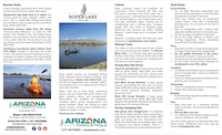
Download Printable Park Map
Park Map shows you an overview of the park, including camping sites, boat ramps, and more.

Elevation

3130 ft

GPS Coordinates to park entrance

Decimal Degrees (WGS84)
Latitude: 32.758624
Longitude: -109.707456

Degrees, Minutes & Seconds
Latitude: N32 45 31
Longitude: W109 42 26

GPS
Latitude: N 32 45.517 
Longitude: W 109 42.447

UTM 12N
X: 621076 
Y: 3625268

Back to top