
Through early July 2026 the restroom/shower building in Campground A will be closed. A new restroom building will be installed during this timeframe. Portable restrooms will be available throughout the campground, and shower buildings in campground B and group areas will be available. Thank you for your patience as we make these park improvements for you!
Music in the Mountains on Saturday, August 1, 2026 is canceled due to extreme heat.
Trails
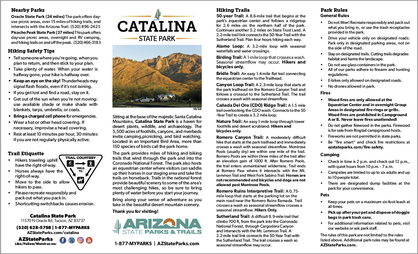
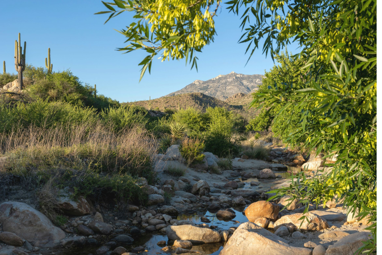
 Sutherland Wash - Catalina State Park
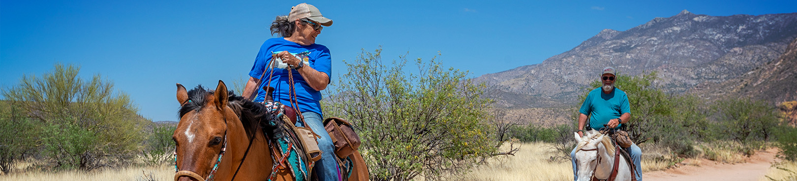
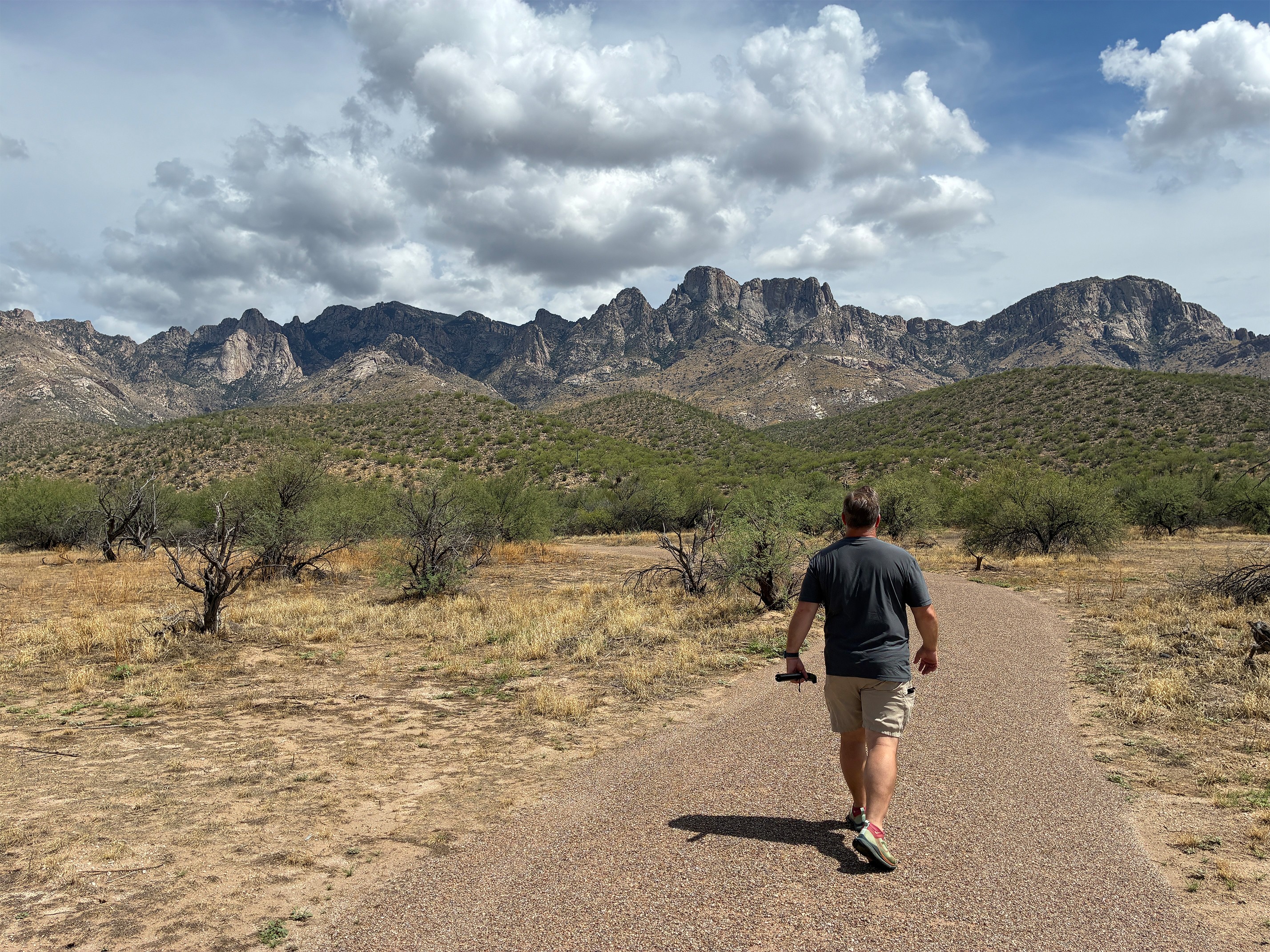
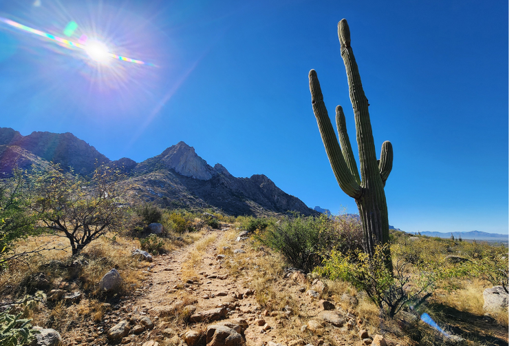
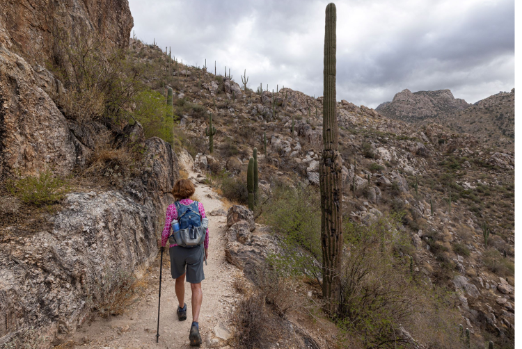
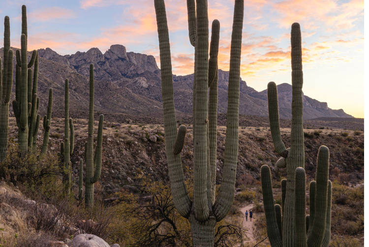
Explore mesquite forests and saguaro-studded canyons, and enjoy amazing views of the Catalina Mountains from miles of trails at Catalina State Park. All eleven trails offer awesome opportunities for hiking, horseback riding, mountain biking, birding, trail running, and more! Several trails feature interpretive signs to help you learn about the fascinating ecology and archaeology of the park. Connect to trails in the Coronado National Forest to get to challenging destinations like the Romero Pools and Mt. Lemmon. We are a pet-friendly park! Dogs are welcome on all park trails and must be on a leash with a maximum length of 6 ft/1.8 m at all times. Restrictions apply for horses, bicycles, and dogs on certain sections of the park trails, see descriptions below for details.
Before your trip, learn about the various desert plants and wildlife that you may encounter in the park, then pick up a copy of our free trail guide at the Visitor Center. All that's left to do is get out there and enjoy the adventure!
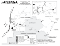
Start Your Adventure From One of Three Trailheads:
Main Trailhead: 1.5 mi/2.4 km north from the Ranger Station at the end of the main entry road.
- GPS Coordinate: 32.425644, -110.908155
- Amenities: Restrooms, water spigots, picnic tables, trash cans, recycling, stage, vending machine, information kiosk, bicycle parking rack, and a seasonal gift shop.
- The main trailhead is graced with a vibrant mosaic tile mural. The Friends of Catalina State Park installed this mural to raise funds for park improvements. It features whimsical depictions of Sonoran Desert plants and animals as well as personalized messages from donors. The Friends group is currently completing phase 3 of this mural. To learn more about how you can support this project by donating a tile, visit FriendsCSP.org
Equestrian Center: 1.0 mi/1.6 km northeast from the Ranger Station at the end of the road to the campgrounds.
- GPS Coordinate: 32.429402, -110.927495
- Amenities: Restroom, water spigots, picnic tables, trash cans, recycling, fire rings, grills, horse stable with 16 stalls, and overnight parking for equestrian trailers (overnight fees apply). Catalina State Park offers horseback riding activities through our concessionaire, Rancho De Los Cerros. Click to Book a Ride
Romero Ruins Ramada Parking Lot: 0.8 mi/1.3 km north from the Ranger Station on the west side of the road.
- GPS Coordinate: 32.423322, -110.919086
- Amenities: reservable shaded ramada, picnic tables, trash cans, recycling, and grills.
50 Year Trail – Moderate | 8.6 mi / 13.8 km | Out-and-Back | Equestrian Center
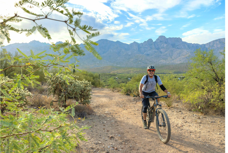
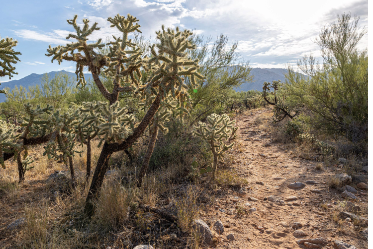
Popular with equestrians and mountain bikers, the 50-Year Trail is great for getting away from crowds and experiencing the serenity of the desert. Beginning at the Equestrian Center, the 50-Year Trail gradually climbs and descends through foothills covered in giant saguaros for 2.4 mi/3.9 km to the park’s northern boundary gate. After leaving the park, the trail continues north for 6.2 mi/10 km through open desert grasslands to challenging mountain biking destinations like “the chutes”. Combine the 50-Year Trail with the Cañada del Oro Ridge Trail to make a 3.2 mi/5.1 km loop from the Equestrian Center. Also, a rocky 2.2 mi/3.5 km Trail Link connects the 50-Year Trail with the Sutherland Trail on the northern side of the park. This trail has sections with steep hills and rocks that create technical mountain biking conditions.
Alamo Canyon Loop Trail – Moderate | 3.2 mi / 5.1 km | Loop | Romero Ruins Ramada Parking Lot
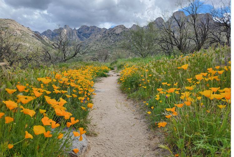
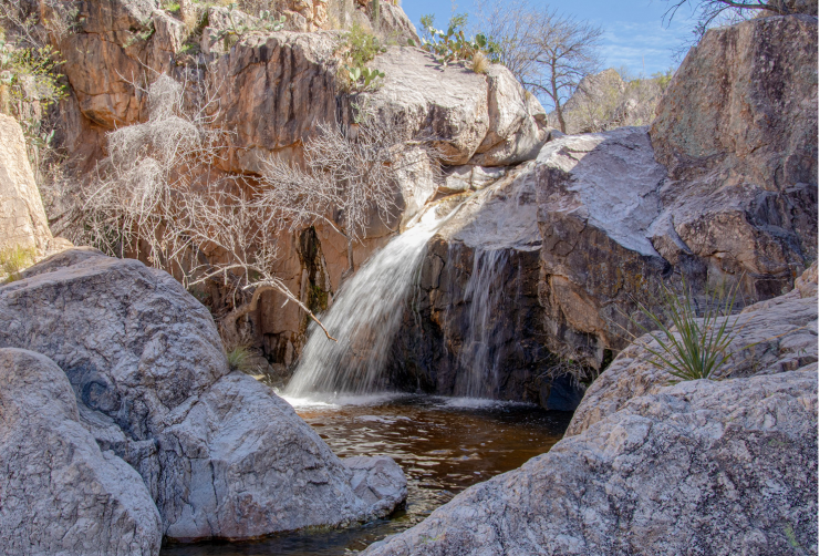
A beautiful loop hike with dramatic mountain views, springtime wildflowers, and seasonal waterfalls. The trail meanders through a forest of mesquite trees and desert willows until it crests a hill with awesome views of giant saguaros and dramatic mountain peaks like Leviathan Dome. Next you'll cruise through the desert grasslands and in spring, enjoy fields of wildflowers lining the trail. Winter (Dec. - Mar.) and summer monsoon rains (Jun. - Sep.) may create seasonal water crossings on the trail.
Birding Trail – Moderate | 1.0 mi / 1.6 km | Loop | Main Trailhead
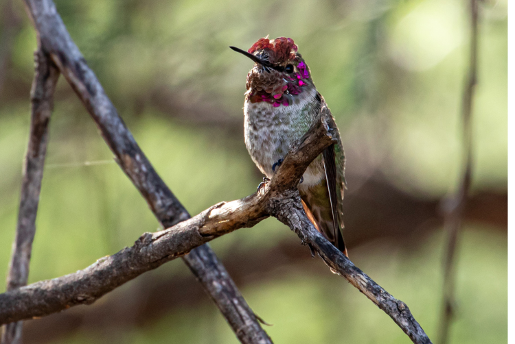
The Birding Trail offers a fantastic introduction to the biodiversity of the Sonoran Desert. As part of a National Audubon Society’s Important Bird Area, Catalina State Park is home to over 150 species of birds! Over the course of a mile, the trail crosses through mesquite bosque, desert, and riparian habitats. Keep your eyes and ears open for the birds that inhabit the landscape. Enhance your experience with binoculars to see birds high up in the trees and saguaros. Trailside educational signs highlight the relationships between unique bird species and their habitat. Winter (Dec. - Mar.) and summer monsoon rains (Jun. - Sep.) may create seasonal water crossings on the trail. This trail has sections with stairs. Restrictions: Horses are not allowed on the trail.
Bridle Trail – Easy | 1.4 mi / 2.3 km | Out-and-Back | Main Trailhead & Equestrian Center
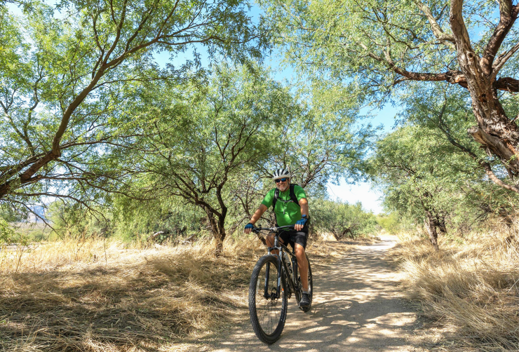
A flat trail with lots of shade that runs between the Equestrian Center and the Main Trailhead. With connections to many of the park's campgrounds and picnic areas, this trail is a convenient and safe choice for many park visitors. The path winds through mesquite forests and stands of giant saguaros, making it ideal for wildlife viewing. The Bridle Trail’s compacted tread is suitable for visitors using strollers, bicycles, and wheelchairs.
Cañada Del Oro Ridge Trail – Moderate | 1.5 mi / 2.4 km | Out-and-Back | Equestrian Center
A peaceful trail through a pristine cactus forest with outstanding views of Oro Valley and the surrounding desert. The Cañada del Oro Ridge Trail breaks off of the 50-Year Trail about 600 ft/183 m up the trail. Continue northeast on the Cañada del Oro Ridge Trail for 1.5 mi/ 2.4 km until it reconnects to the 50-Year Trail to make a 3.2 mi/5.1 km loop back to the Equestrian Center.
Canyon Loop Trail – Moderate | 2.3 mi / 3.7 km | Loop | Main Trailhead
Spectacular views, seasonal creeks, and a variety of habitats to explore make the Canyon Loop one of the park’s most popular trails. The Canyon Loop is technically made up of the Romero Canyon Trail, Sutherland Trail, and the Canyon Loop Connector. Signs along the trail are labeled “Canyon Loop” to make following this beautiful path easier for all. Start the loop from the Sutherland Trail or the Romero Canyon Trail at the Main Trailhead. After crossing washes and grasslands with lovely views of the mountains, the trail passes through a desert riparian area. Strolling under tall sycamore and ash trees nestled in the canyon makes it feel like you're not in the desert anymore, especially when the creeks are flowing! Winter (Dec. - Mar.) and summer monsoon rains (Jun. - Sep.) may create seasonal water crossings on the trail. This trail has sections with stairs and steep hills.
Catalina Vista Trail – Easy | 1.7 mi / 2.7 km | Out-and-Back | Main Trailhead
Enjoy incredible views of Pusch Ridge and Mt. Lemmon from the Catalina Vista Trail! This flat, easy path connects the park entrance to the Main Trailhead over 1.7 mi/2.7 km. The trail surface is wide and made of compacted decomposed granite, making it suitable for runners, cyclists, and stroller use. Please note that this trail is not ADA accessible at this time. The Catalina Vista Trail offers visitors a safe alternative to cycling or running on the main park road, especially for those entering the park from the nearby Huckleberry Loop near Oracle Road. Winter (Dec. - Mar.) and summer monsoon rains (Jun. - Sep.) may create seasonal water crossings on the trail. Fees apply at all times on this trail.
Trail Link – Moderate | 2.2 mi / 3.2 km | Out-and-Back | Main Trailhead & Equestrian Center
A rocky trail that connects the Sutherland and 50-Year Trails from east to west on the northern side of the park. Long views of the mountains, solitude, and full sun exposure are what you can expect on this trail. In cooler temperatures, combine the Trail Link with the 50-Year, Sutherland, and Bridle Trails to make a big 8.8 mi/14.2 km loop around the park. Please bring a map, compass, or GPS device to follow this trail due to infrequent trail maintenance and the presence of unofficial “social” trails in the area.
Nature Trail – Easy | 1.0 mi / 1.6 km | Loop | Main Trailhead
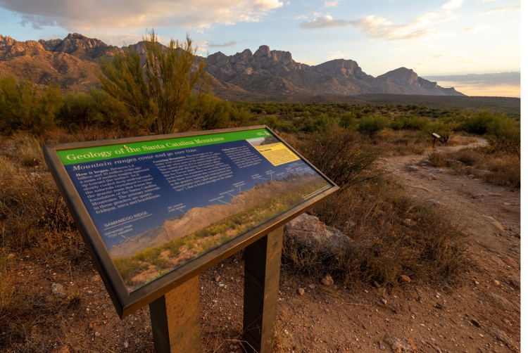
Get acquainted with the park’s local plants, animals, and the peaks of the Catalina Mountains on the Nature Trail. The trail starts with a steep climb up a saguaro-covered hillside near the Main Trailhead road roundabout. After climbing the hill, the Nature Trail gently loops through foothills with nice desert scenery. Trailside signage will educate you on local plants, wildlife, and climate. In addition, you can learn the names of the dramatic peaks overlooking the park and the geology of the Santa Catalina Mountains. Restrictions: Horses are not allowed on the trail.
Romero Canyon Trail – Difficult | 7.2 mi / 11.6 km | Out-and-Back | Main Trailhead
The Romero Canyon Trail leads to epic destinations like the refreshing waters of Romero Pools. Start from the Main Trailhead parking lot where you’ll cross Sutherland Wash and head northeast for 1.0 mi/1.6 km on an easy walk to the Montrose Pools overlook. Montrose Pools are a series of seasonal pools and waterfalls found throughout Montrose Canyon. The next 1.8 mi/2.9 km of the trail to Romero Pools are difficult. Prepare for a steep, uphill climb through the Pusch Ridge Wilderness on rocky, uneven terrain with 1,000 ft/305 m elevation gain. Seasonal pools and waterfalls can be found throughout Romero Canyon once you reach the creek crossing 2.8 mi/4.5 km east on the trail. Picnicking, water play, and backpacking are all popular activities in the Romero Pools area. Plan on at least 5.6 mi/9.0 km and 4 hours of hiking round-trip from the Main Trailhead to Romero Pools.
To continue to Romero Pass, the trail climbs another 4.4 miles to Romero Pass at approximately 6,000 feet elevation. The trail intersects with the Mt. Lemmon Trail and West Fork Sabino Trail. From the trailhead to Romero Pass is 7.2 miles with approximately 3,300 feet of elevation gain and about 10 hours round trip.
The trail is normally unmaintained beyond Romero Pools. Bring a map, compass, or GPS device if traveling to Romero Pass. Winter storms and summer monsoons may create seasonal water crossings.
Restrictions: Dogs and bicycles are not allowed in the Bighorn Sheep Management Area / Pusch Ridge Wilderness beyond the Forest Service gate approximately one mile from the trailhead.
From January 1 through April 30, travel more than 400 feet off designated Forest Service trails is prohibited due to bighorn sheep lambing season. Horses are not recommended beyond the Montrose Pools overlook due to stairs and narrow rock passages.
Romero Ruins Interpretive Trail – Easy | 0.8 mi / 1.3 km | Loop | Romero Ruins Ramada Parking Lot
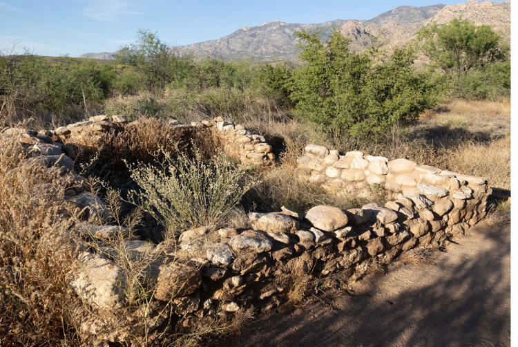
This informative loop trail takes you through thousands of years of archaeological history in less than 30 minutes! Visit an ancient Hohokam site where you can see surface features from one of the largest prehistoric settlements in the Tucson basin, dating back to around 500 AD! Trailside signs explain what archaeologists know about how the Hohokam lived, worked, and played sports in the prehistoric village. You'll also learn about the late-1800s Romero homestead and see its foundation still standing after all this time. For the protection of cultural resources, no excavation or collection of artifacts is allowed. Winter (Dec. - Mar.) and summer monsoon rains (Jun. - Sep.) may create seasonal water crossings on the trail. This trail has sections with stairs. Restrictions: Horses and bicycles are not allowed on the trail.
Sutherland Trail – Moderate | 9.9 mi / 15.9 km | Out-and-Back | Main Trailhead
Known for wildflowers and seasonal water features like Dripping Springs, the Sutherland Trail is a staple of the hiking scene at Catalina State Park. The first 2.6 mi/4.2 km from the Main Trailhead are easy hiking with the trail gradually climbing to the Trail Link which heads west for 2.2 mi/3.2 km to connect with the 50-Year Trail. Continuing east on Sutherland, this difficult trail climbs 7.3 mi/11.7 km through Cargodera Canyon with a steep and rocky ascent ending at the Mt. Lemmon Trail (additional 1.5 mi/2.4 km to Mount Lemmon summit). The total elevation gain from start to finish on the Sutherland Trail is around 5,900 ft/1,798 m. Please bring a map, compass, or GPS device to follow this trail to the Mt. Lemmon Trail to avoid getting lost. Winter (Dec. - Mar.) and summer monsoon rains (Jun. - Sep.) may create seasonal water crossings on the trail. This trail has sections with stairs and steep hills. Restrictions: Dogs and bicycles are not allowed in the Bighorn Sheep Management Area/Pusch Ridge Wilderness about 1.0 mi/1.6 km up the trail. From January 1st to April 30th, traveling more than 400 ft/122 m off Forest Service system trails is prohibited due to the bighorn sheep lambing season.
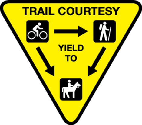 Trail Etiquette and Rules
Please practice trail etiquette while exploring the park’s trails and make way for visitors with the right-of-way.
- Horses always have the right-of-way above all other trail users.
- Hikers traveling uphill have the right-of-way.
- Mountain bikers must yield to horses and hikers at all times.
Pets
Dogs are welcome on all park trails and in the washes but must be kept on a leash with a maximum length of 6 ft/1.8 m at all times.
Restrictions apply for dogs on the Romero Canyon and Sutherland Trails.
Pick up any pet waste and dispose of it in park trash cans. Do not litter by leaving doggie bags on the side of the trail.
Recreate Responsibly!
Keep AZ Beautiful and learn how to Recreate Responsibly in the park!
Drones are not allowed to fly in the park without a Filming Permit from Arizona State Parks and Trails for news, publicity, or promotional purposes.
Camping is only allowed in designated campgrounds within the park. Backpackers must pay overnight vehicle parking fees.
Motorized vehicles and electric bicycles are only allowed on designated park roads.
Additional Arizona State Parks and Trails Laws, Rules and Policies
Arizona hiking trails can be found throughout the State Park system, and many of them are pet friendly! With trail options available statewide, you can always find an adventure!

