
Maps
Cattail Cove Location and Directions
Map & Driving Directions to Cattail Cove State Park
What3Words: ///innately.phantom.tipped
Cattail Cove State Park Map & Brochure
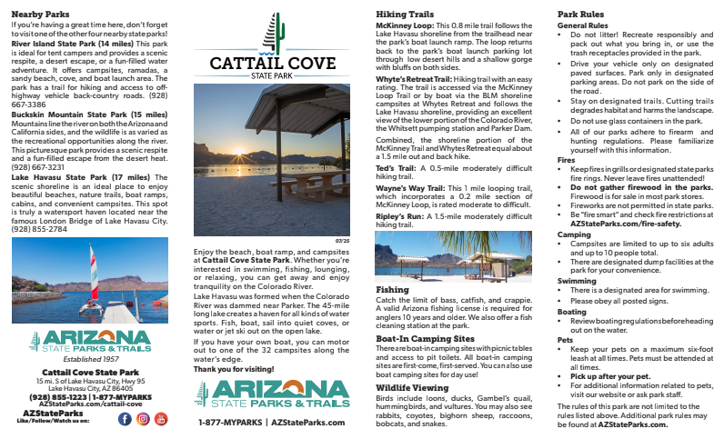
Download a printable park map.
Park Map shows you an overview of this Colorado River park, including camping sites, trails and other park facilities. This two-page brochure also includes general park information about what you can expect on your trip.
Elevation
450 ft
GPS Coordinates to Park Entrance
Decimal Degrees (WGS84)
Latitude: 34.355075
Longitude: -114.165877
Degrees, Minutes & Seconds
Latitude: N34 21 18
Longitude: W114 09 57
GPS
Latitude: N 34 21.304
Longitude: W 114 09.953
UTM 11N
X: 760670
Y: 3805167

