
Park improvements are in process. There may be construction noise on weekdays.
On Saturday, June 13, 2026, the park's riverfront campsites #69-84 will be closed for the weekend (6/12-6/14) for the 48th Annual Parker Tube Float. No day use will be permitted on the day of the event, June 13.
Maps
Park Location and Directions
What3Words: ///pianist.certain.brash
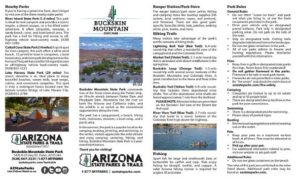
Buckskin Mountain Park Map
Before you visit, get an overview of the park and download a Printable Park Map.
Elevation
420 ft
GPS Coordinates to park entrance
Decimal Degrees (WGS84)
Latitude: 34.254255
Longitude: -114.160942
Degrees, Minutes & Seconds
Latitude: N34 15 15
Longitude: W114 09 39
GPS
Latitude: N 34 15.255
Longitude: W 114 09.657
UTM 11N
X: 761437
Y: 3793995

