There is currently an excessive heat warning in place. Exercise caution, do not hike in the heat of the day (10-4 p.m.), and properly prepare for a summer hike.

Please be aware of roadwork along SR 89 that may add time to your drive to the park.
 

Until further notice, both Granite Mountain Hotshots and Yarnell Hill Fire Memorial parks will be closed on Mondays and Tuesdays.


Parking is limited. Please do not park alongside State Route 89.

Trail Map

Park Location and Directions

Google Map

What3Words: ///sheen.rafters.shopping

GPS Coordinates to park entrance

Decimal Degrees (WGS84)
Latitude: 34.2114313
Longitude: -112.7699444

Granite Mountain Hotshots Memorial Park & Trail Map

Before you visit, get an overview of the park by downloading a printable park map.

Download Granite Mountain Hotshots Trail Map

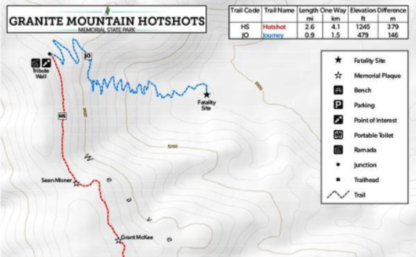
Click map to download.

Elevation

4318 ft

Back to top