
Geology and Tours
Park Geology
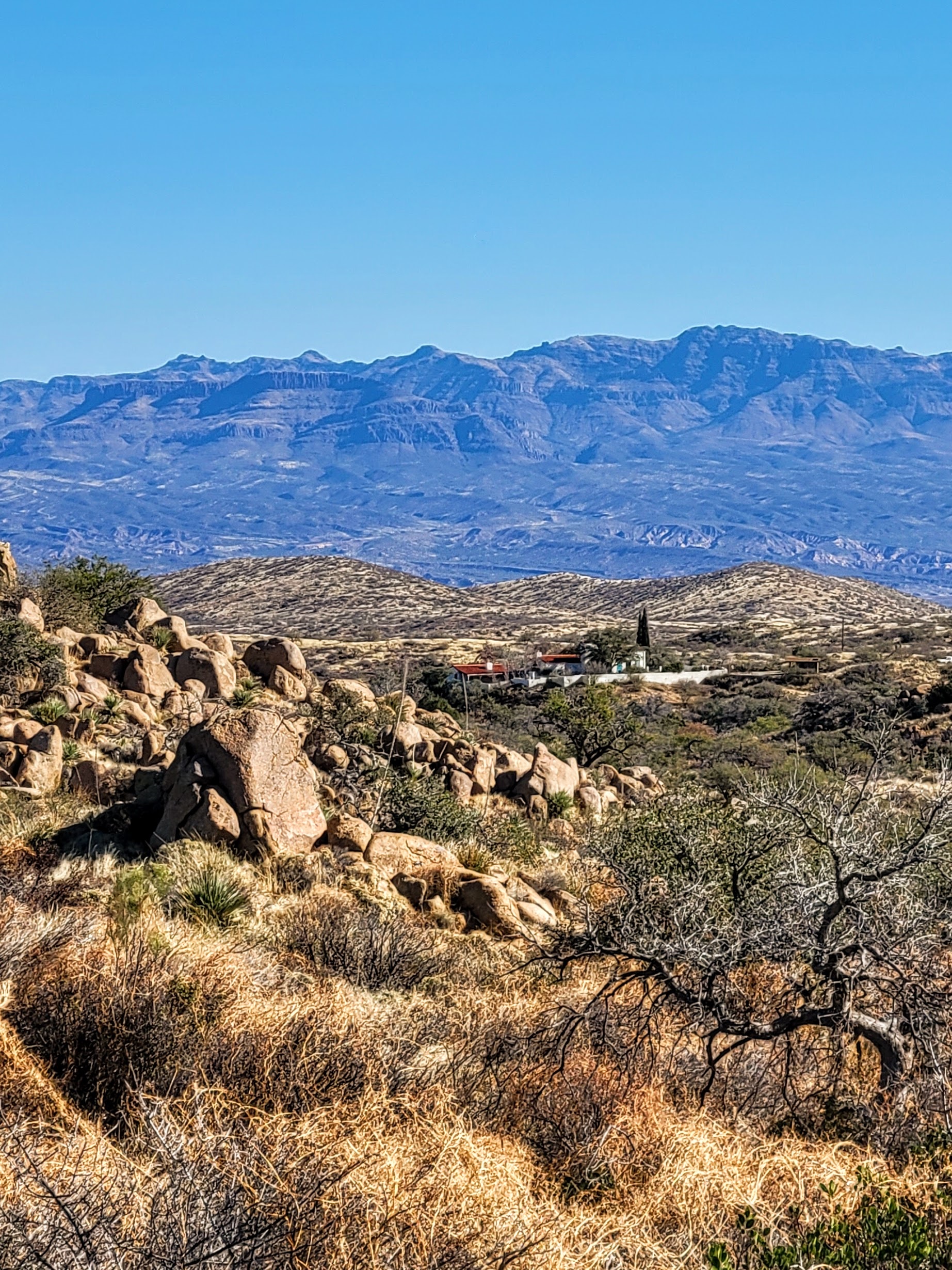
Southern Arizona’s sky islands and desert plains reveal a fascinating geologic history at Oracle State Park. The park's Geology Trail showcases Arizona’s unique rock formations shaped by over 20 million years of fault movements, erosion, and mountain building. Visitors can explore these ancient landscapes through guided geology tours, immersing themselves in the rich Arizona geology of the region. Plan your visit to Oracle State Park and experience firsthand the captivating rock formations and scenic high desert terrain, all while learning about the forces that shaped this awe-inspiring area.
Significant geologic events
 1.7 billion years ago, this area was part of an island chain located off the coast of a continent during a period of early mountain building. Rock formed from sediments that accumulated at the base of sea canyons. This sedimentary rock was later metamorphosed as Pinal schist, the oldest rock of this area. Fragments of this rock are visible at the park.
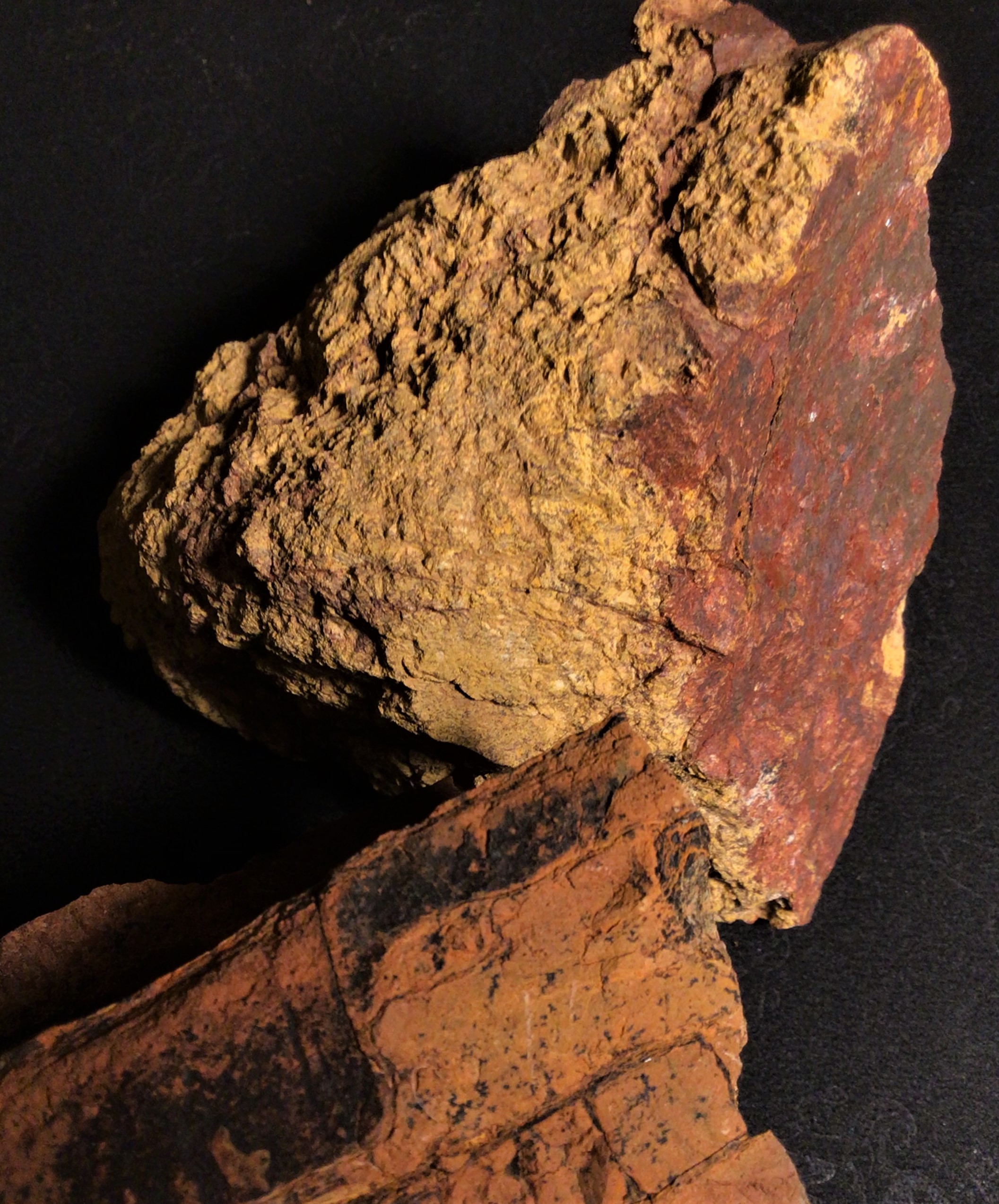
1.4 billion years ago, magmatic activity deep beneath the surface enabled the formation of Oracle Granite. It is the basement rock of the area. Oracle Granite’s stacked boulders and balanced rocks dominate the park’s landscape.
 1.0 to 1.4 billion years ago, molten rock intruded into Oracle Granite, forming igneous dikes and sills. Hydrothermal solutions associated with the magma formed minerals like tourmaline. This was also a time of sedimentation from shoreline erosion and sea action. The Apache Group of sedimentary rocks formed during this time, and their fragments are scattered across the park’s bajada.
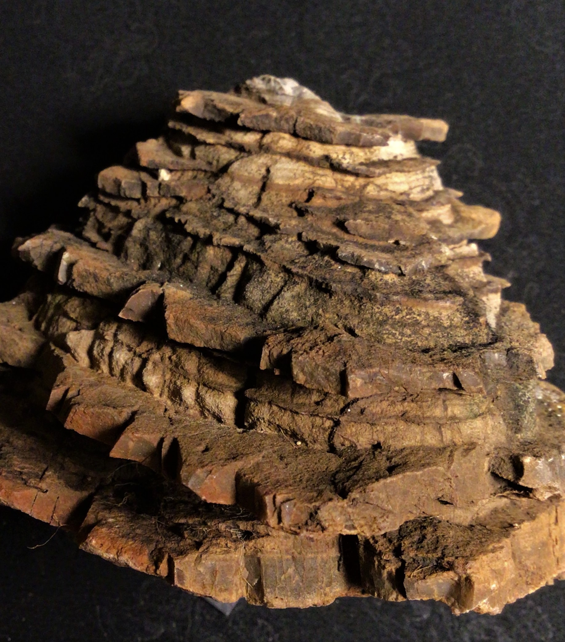
252 to 541 million years ago, shallow seas covered this area multiple times. This created fossil-bearing Paleozoic limestone. These rocks later hosted valuable mineral deposits.
 70-80 million years ago, North America was gliding westward, colliding with the crust of the ocean. The downward movement of ocean crust initiated magmatic activity, producing a Laramide Granitic Porphyry rock that intruded into Oracle granite. This time, the hydrothermal solutions were rich in copper and smaller amounts of silver, gold and molybdenum. The porphyry rock related to this mineral deposit is exposed at the surface along trails in the park. Although mining never occurred within the park boundary, Oracle State Park is surrounded by numerous underground and open pit mines that have extracted valuable minerals over the past 100 years.
This history and more can be explored along the park’s Geology Trail. Information about the trail and guided geology hikes can be found below.
Geology Tours
I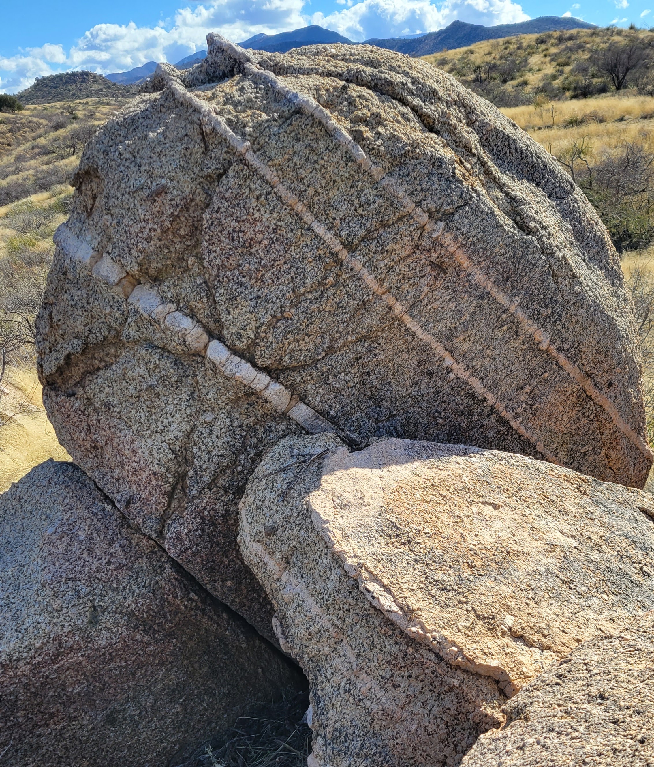 n 2022, Oracle State Park launched a 1.2-mile Geology Trail. Starting at the park’s Group Use Area Trailhead, hikers wind through igneous intrusions, mineral deposits, bedrock pediment, and alluvial fans that showcase the past 1.7 billion years of geologic history. From high points along the trail, there are unobstructed views of the volcanic Galiuro Mountains, the Santa Catalina Mountains, and the San Pedro Valley.
There are two ways to experience Oracle State Park’s Geology Trail. Join a Geologist/park staff-led tour by calling the visitor center at 520-896-2425 or sign up online (search Oracle under Places). You can also enjoy a virtual geology tour by clicking the link in the section below.
Virtual Geology Tour
We are excited to present our new Virtual Geology Tour, a collaborative effort between Oracle State Park and the Friends of Oracle State Park!
Click the link below to virtually walk through each of the ten stops on our stunning geology trail. Along the way, you will be able to click on icons to view photos and diagrams, learn interesting information, and pan around each stop in 360 degrees. Once you've checked out our virtual tour, consider stopping by in person to see it for yourself, either by signing up for an in-person tour or taking a self-guided tour of the trail. We hope you enjoy this immersive experience!
Self-guided Tours
You can also take a self-guided tour using one of the Geology Trail maps below. Either download the map in advance or pick one up at the Kannally Ranch House.
Geology Tour Map (print version)
Recorded Geology Talks
Enjoy the recordings below of Oracle State Park's "Geology of the Week" virtual talks with volunteer geologist Tom Buckley.
Sea Lilies
Did you know that the fossils of sea creatures can be found in rocks at Oracle State Park? Learn about them with the park's volunteer geologist, Tom Buckley!
Tourmaline
Did you know that a shiny mineral used in jewelry can be found right at Oracle State Park? Learn about tourmaline with the park's volunteer geologist, Tom Buckley!
Stacked Boulders
As soon as you enter Oracle State Park, you are quickly surrounded by dozens of boulders rising above the mesquite canopy. Where did they come from? You might be surprised by their origin story, as shared by the park's volunteer Geologist, Tom Buckley.
Evolution of the Catalina Mountains
The ground below us feels like a stable thing, but over time, it has changed and shifted. Hear from geologist Tom Buckley about the historic geological events that have created the interesting topography we see in southern Arizona today. Faults lifted, the Sky Islands rose, valleys sank, and erosion changed the peaks further still. Learn the evidence to look for around you that illustrates geologic history!
Lichens and Rock Weathering
Oracle State Park's latest geology feature is all about lichens, the colorful patches of life on the boulders found at the park. Hear geologist Tom Buckley discuss this unique organism, and how it breaks down rocks over time.
Undersea Avalanches
Xenoliths are the oldest rocks embedded in the granite at Oracle State Park. How did they get there? Ocean currents transported and deposited sediment which compacted and later broke free by the force of earthquakes. What was once at the bottom of the ocean is now on at the surface. Listen as geologist Tom Buckley explains.
The Vanished Lake
Learn how tributaries, washes, and a now-vanished lake left minerals that are clues for us today about the history of the region's landscape.
To fully experience the captivating geologic features at Oracle State Park, visitors can explore a variety of trails that wind through the high desert landscape. These trails offer a unique opportunity to witness Arizona’s impressive rock formations and learn about the geological forces that shaped the region. Whether you join a guided geology tour or embark on a self-guided adventure, the stunning views and rich history of the park make it a must-visit destination. Plan your trip today and uncover the natural wonders of this hidden gem in Southern Arizona.

