Maps
Park Location and Directions
What3Words: ///notepads.horizons.shaving
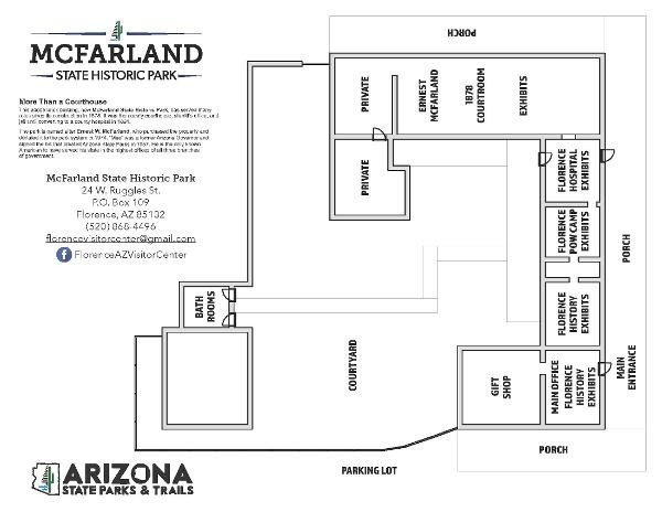
McFarland Park Map
Download Printable Park Map
Park Map shows you an overview of the historic buildings complete with museum exhibits.
Elevation
1500 ft
GPS Coordinates to park entrance
Decimal Degrees (WGS84)
Latitude: 33.035947
Longitude: -111.38743
Degrees, Minutes & Seconds
Latitude: N33 02 09
Longitude: W111 23 14
GPS
Latitude: N 33 02.157
Longitude: W 111 23.246
UTM 12N
X: 463822
Y: 3655339


