Geology and Tours
Park Geology
For many millions of years, the crust of southern Arizona was raised and thickened as a slab of ocean rock wedged its way under the surface. Between 15 and 35 million years ago, the nature of the ocean slab’s movement changed. The rate of descent slowed, and the dip steepened, resulting in volcanic eruptions and crustal thinning. Many geologists believe that the surface area of southern Arizona doubled in size and the crust halved in thickness during this period.
Picacho Peak State Park provides a unique snapshot of the volcanism, crustal extension, tilting, faulting, mineralization, and erosion that defined this area over the past 23 million years.
Interested in a geology tour of the park? Check out this awesome guided event!
Geologic Events Recorded in the Rocks and Landforms
 Volcanic Activity
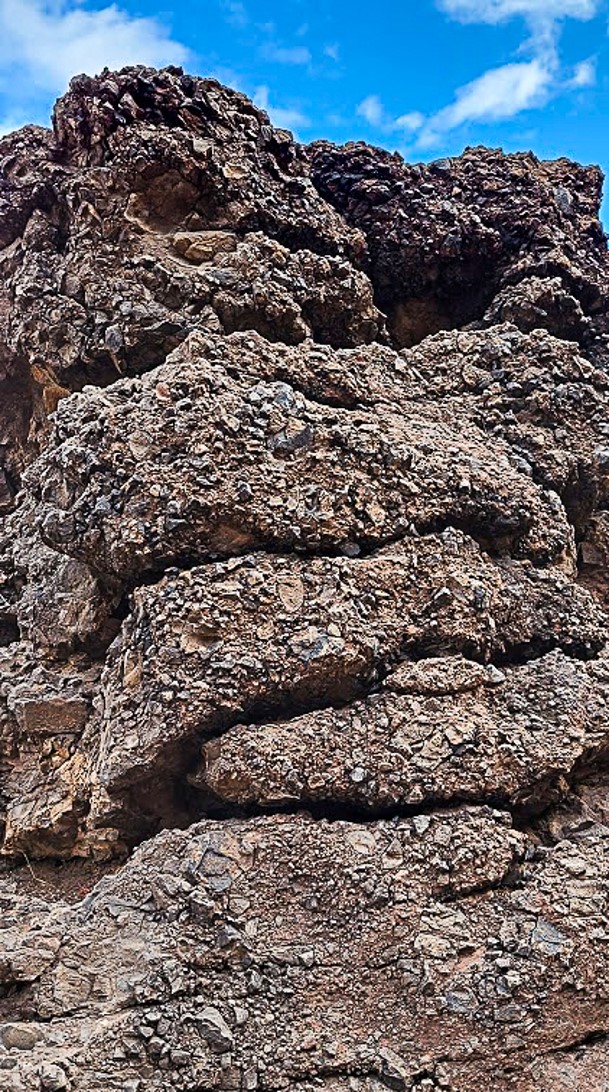
Between 22-23 million years ago, a volcanic field comprised of several volcanoes erupted periodically for several hundreds of thousands of years. Each eruption produced lava that filled a topographically lower surface which would become Picacho Peak State Park.
Thousands of feet of volcanic lava rocks were stacked. The composition of the lava sometimes varied with eruption creating basaltic- andesite, andesite, and dacite rocks layers. At the park, look closely along the trails and you can see the various lava rock compositions.
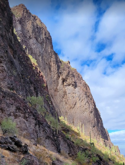
Detachment Faulting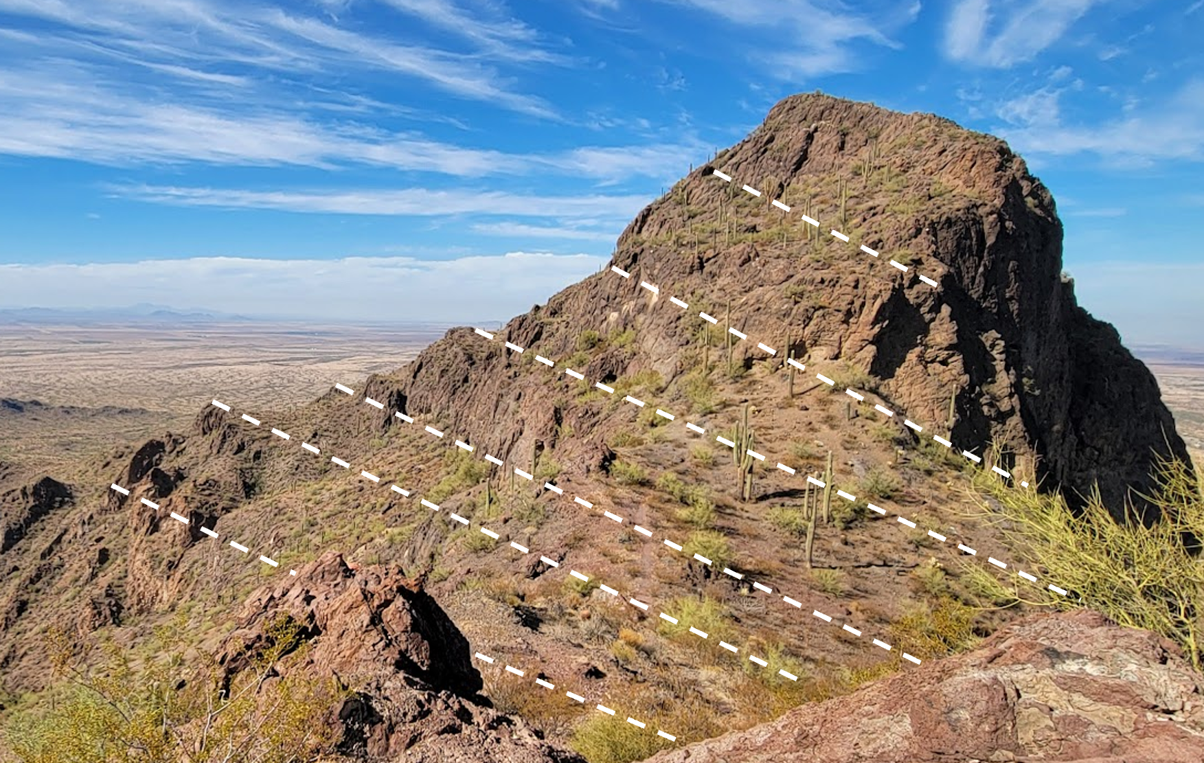
Before, during and after volcanic eruptions at the park, the crust of the region was subjected to forces that extended and thinned it. A major sub-horizontal normal fault, called the Picacho Mountains Detachment Fault, activated as the crust was pulled apart. Movement of the rock above the fault plane is illustrated by several features at the park, including the 40 degree tilt of the thick volcanic rock layers.
Disruption of Volcanic Rock
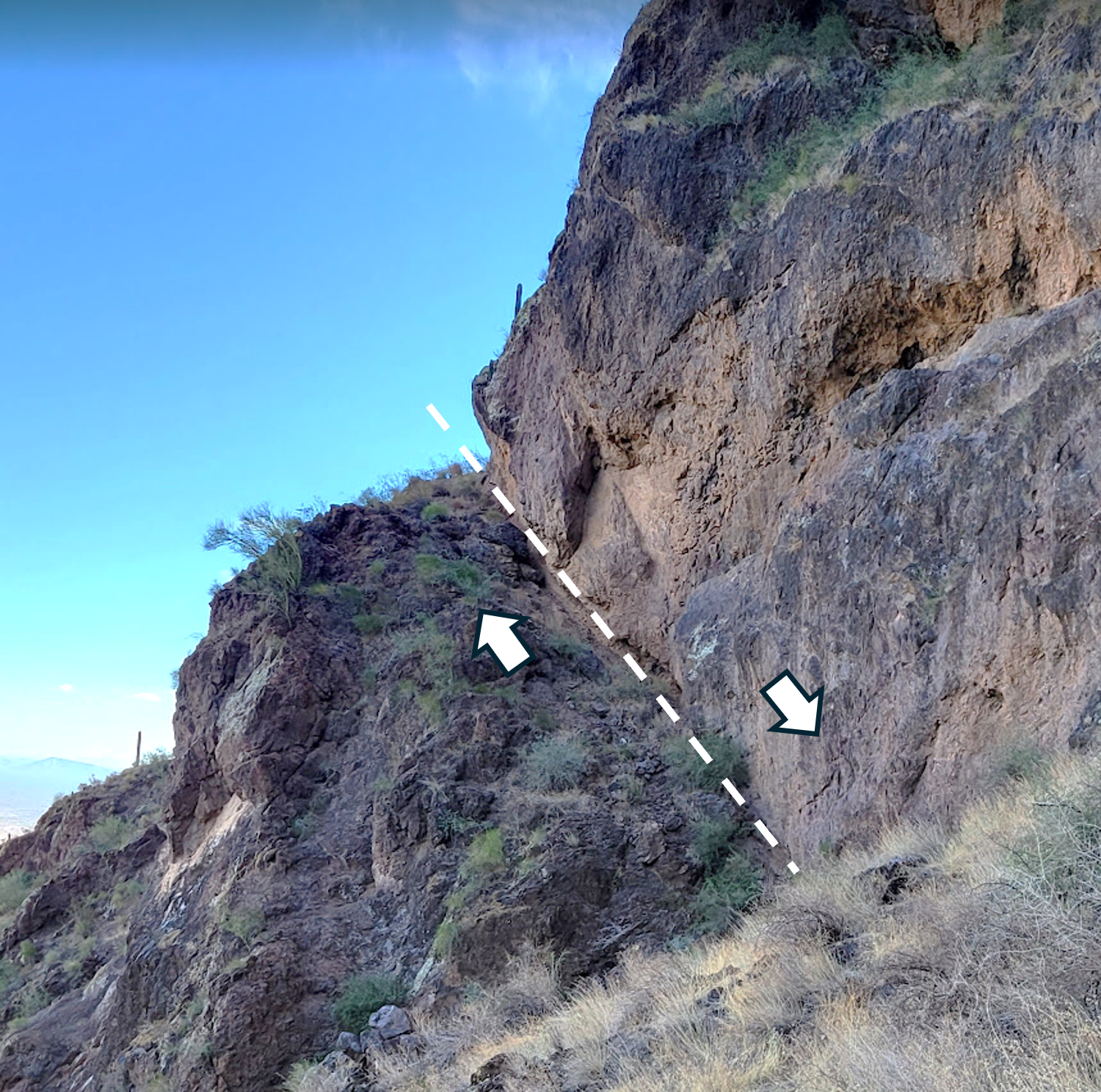 In addition to detachment faulting, further extension of the crust resulted in the activation of numerous normal faults. Most are oriented northwest-southeast. As landmasses were hoisted and others descended, the volcanic field was broken up.
At the park, the youngest lava layer is located at the summit of the ridge, but it is also found at the campground, more than 1,000’ below, the result of displacement along faults.
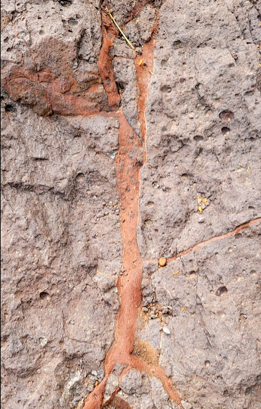
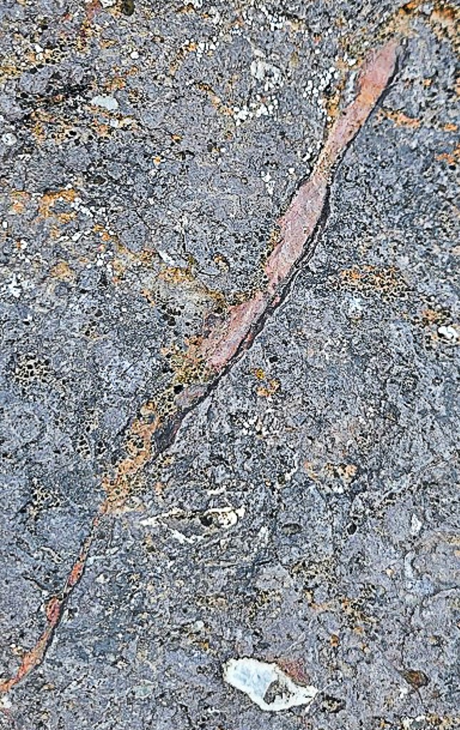
Mineralization
Fluids, called hydrothermal solutions, carry dissolved minerals like copper, iron, barite, and silver. These solutions traveled along the many faults of the park, depositing base and precious minerals in the adjacent volcanic rock.
At the park, you will see veins of minerals that were created by hydrothermal solutions as they circulated 22 million years ago.
 Self-Guided Geology Tours
You can take a self-guided geology tour. The geology tour is a 2-mile out-and-back hike that follows the Hunter Trail, with geologic points of interest identified and described along the way.
There are several ways to acquire the free self-guided geology tour brochure:
- Download the cell phone version Self-Guided Tour (phone version)
- Print the full version in advance Self-Guided Tour (print version)
- Scan the QR code at the trailhead with your phone
- Pick up a printed copy at the visitor center

